Naila night lights from space
Night Light of Naila (Bavaria) from space (Germany) Src. Average luminocity for 10x10km area is 2.9132% and for 50x50km: 1.8181%.
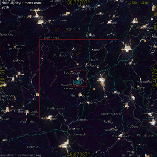
Analysis of Naila night lights 2016
Square area 10x10 km:
 0%
0%90-99
0%80-89
0.14%70-79
0.42%60-69
0%50-59
1.26%40-49
2.66%30-39
0%20-29
0.14%10-19
0.42%0-9
94.96%Square area 50x50 km:
0.22%90-99
0.27%80-89
0.16%70-79
0.27%60-69
0.09%50-59
0.32%40-49
0.34%30-39
0.36%20-29
0.19%10-19
0.89%0-9
96.89%Clear (daylight) street map image can be seen on geolist.org.
Map coordinates:
50° 46' 37.5" North, 11° 0' 5.4" East
50° 19' 49.2" North, 11° 42' 16.7" East
49° 52' 45.7" North, 12° 24' 27.9" East
Some cities around Naila sort by population:
• Hof
14.9 km =9.3 mi,  97°
97°
• Kronach
28.3 km =17.6 mi,  249°
249°
• Münchberg
16.7 km =10.4 mi,  159°
159°
• Schwarzenbach an der Saale
20.3 km =12.6 mi,  126°
126°
• Rehau
25.1 km =15.6 mi,  111°
111°
• Helmbrechts
10.6 km =6.6 mi,  175°
175°
• Bad Lobenstein
14.3 km =8.9 mi,  341°
341°
• Oberkotzau
18 km =11.2 mi, 114°
2867138 (p: 8,441)
Sources (retrieved 2019-11-25):
» Earth at Night: Flat Maps 2012, 2016