Mühlhausen night lights from space
Night Light of Mühlhausen (Thuringia) from space (Germany) Src. Average luminocity for 10x10km area is 9.979% and for 50x50km: 1.6358%.
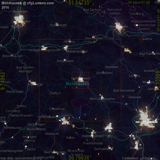
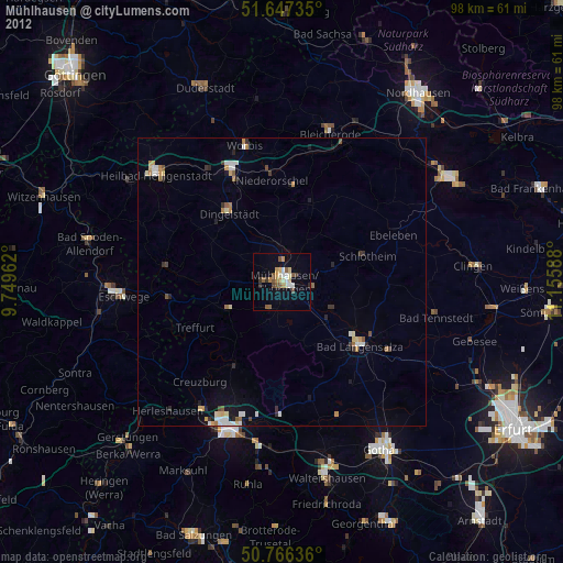
Analysis of Mühlhausen night lights 2016
Square area 10x10 km:
 0.98%
0.98%90-99
1.68%80-89
1.26%70-79
1.4%60-69
1.4%50-59
0.28%40-49
2.94%30-39
0.7%20-29
1.12%10-19
0.7%0-9
87.54%Square area 50x50 km:
0.16%90-99
0.28%80-89
0.27%70-79
0.13%60-69
0.14%50-59
0.15%40-49
0.33%30-39
0.23%20-29
0.21%10-19
0.39%0-9
97.7%Clear (daylight) street map image can be seen on geolist.org.
Map coordinates:
51° 38' 50.5" North, 9° 44' 58.6" East
51° 12' 32.3" North, 10° 27' 9.9" East
50° 45' 58.9" North, 11° 9' 21.2" East
Some cities around Mühlhausen sort by population:
• Eisenach
27.1 km =16.8 mi,  200°
200°
• Eschwege
28 km =17.4 mi,  264°
264°
• Bad Langensalza
17.6 km =10.9 mi,  129°
129°
• Heilbad Heiligenstadt
28.9 km =18 mi,  310°
310°
• Leinefelde-Worbis
21.8 km =13.5 mi,  336°
336°
• Bleicherode
27 km =16.8 mi,  17°
17°
• Treffurt
17.2 km =10.7 mi,  242°
242°
• Worbis
24.3 km =15.1 mi,  345°
345°
2867996 (p: 38,108)
Sources (retrieved 2019-11-25):
» Earth at Night: Flat Maps 2012, 2016