Worbis night lights from space
Night Light of Worbis (Thuringia) from space (Germany) Src. Average luminocity for 10x10km area is 4.9439% and for 50x50km: 1.1538%.
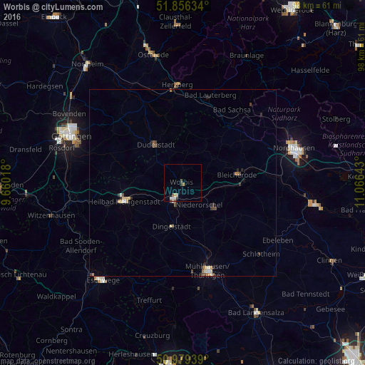
Analysis of Worbis night lights 2016
Square area 10x10 km:
 0.4%
0.4%90-99
1.74%80-89
0.8%70-79
0%60-69
0.53%50-59
0.8%40-49
0.8%30-39
0.53%20-29
0.53%10-19
0%0-9
93.85%Square area 50x50 km:
0.08%90-99
0.17%80-89
0.21%70-79
0.11%60-69
0.16%50-59
0.12%40-49
0.3%30-39
0.19%20-29
0.23%10-19
0.07%0-9
98.36%Clear (daylight) street map image can be seen on geolist.org.
Map coordinates:
51° 51' 22.8" North, 9° 39' 36.6" East
51° 25' 11.9" North, 10° 21' 47.9" East
50° 58' 45.8" North, 11° 3' 59.1" East
Some cities around Worbis sort by population:
• Mühlhausen
24.3 km =15.1 mi,  165°
165°
• Duderstadt
12.6 km =7.8 mi,  325°
325°
• Heilbad Heiligenstadt
16.3 km =10.1 mi,  253°
253°
• Herzberg am Harz
26.2 km =16.3 mi,  356°
356°
• Leinefelde-Worbis
4.4 km =2.7 mi,  215°
215°
• Bad Lauterberg im Harz
24.8 km =15.4 mi,  17°
17°
• Bad Sachsa
23.6 km =14.7 mi,  34°
34°
• Bleicherode
14.6 km =9.1 mi,  81°
81°
2806192 (p: 5,371)
Sources (retrieved 2019-11-25):
» Earth at Night: Flat Maps 2012, 2016