Heilbad Heiligenstadt night lights from space
Night Light of Heilbad Heiligenstadt (Thuringia) from space (Germany) Src. Average luminocity for 10x10km area is 7.0658% and for 50x50km: 2.7072%.
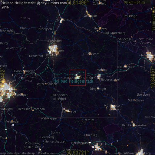
Analysis of Heilbad Heiligenstadt night lights 2016
Square area 10x10 km:
 0.7%
0.7%90-99
0.98%80-89
2.52%70-79
1.4%60-69
0%50-59
0.28%40-49
0.28%30-39
0.84%20-29
0.84%10-19
0%0-9
92.16%Square area 50x50 km:
0.36%90-99
0.57%80-89
0.41%70-79
0.2%60-69
0.18%50-59
0.26%40-49
0.46%30-39
0.25%20-29
0.41%10-19
1.67%0-9
95.23%Clear (daylight) street map image can be seen on geolist.org.
Map coordinates:
51° 48' 53.9" North, 9° 26' 3.6" East
51° 22' 41.5" North, 10° 8' 14.8" East
50° 56' 14" North, 10° 50' 26.1" East
Some cities around Heilbad Heiligenstadt sort by population:
• Duderstadt
17.2 km =10.7 mi,  29°
29°
• Witzenhausen
20 km =12.4 mi,  258°
258°
• Leinefelde-Worbis
13.1 km =8.1 mi,  85°
85°
• Friedland
15.9 km =9.9 mi,  286°
286°
• Rosdorf
21.3 km =13.2 mi,  309°
309°
• Gemeinde Friedland
14.8 km =9.2 mi, 286°
• Bad Sooden-Allendorf
16.4 km =10.2 mi,  223°
223°
• Worbis
16.3 km =10.1 mi,  73°
73°
2907545 (p: 17,230)
Sources (retrieved 2019-11-25):
» Earth at Night: Flat Maps 2012, 2016