Mellrichstadt night lights from space
Night Light of Mellrichstadt (Bavaria) from space (Germany) Src. Average luminocity for 10x10km area is 1.514% and for 50x50km: 0.8937%.
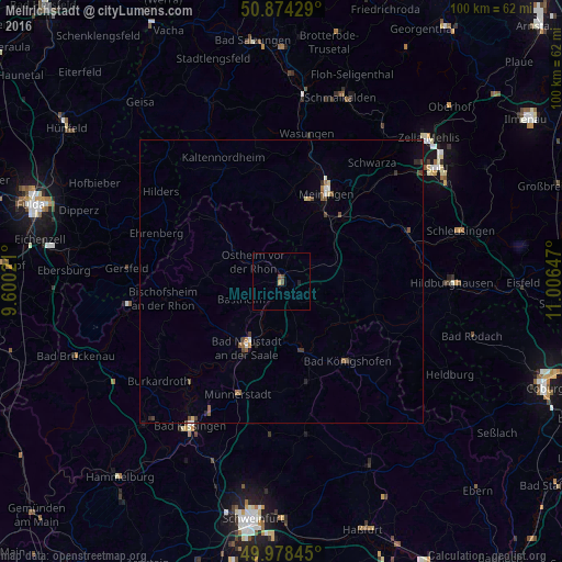
Analysis of Mellrichstadt night lights 2016
Square area 10x10 km:
 0%
0%90-99
0%80-89
0.56%70-79
0%60-69
0%50-59
0%40-49
1.68%30-39
0%20-29
0%10-19
0.56%0-9
97.2%Square area 50x50 km:
0.04%90-99
0.09%80-89
0.1%70-79
0.07%60-69
0.1%50-59
0.25%40-49
0.26%30-39
0.12%20-29
0.2%10-19
0.09%0-9
98.68%Clear (daylight) street map image can be seen on geolist.org.
Map coordinates:
50° 52' 27.4" North, 9° 36' 0.8" East
50° 25' 42.6" North, 10° 18' 12" East
49° 58' 42.4" North, 11° 0' 23.3" East
Some cities around Mellrichstadt sort by population:
• Meiningen
17.4 km =10.8 mi,  27°
27°
• Bad Kissingen
29.8 km =18.5 mi,  212°
212°
• Bad Neustadt an der Saale
13.7 km =8.5 mi, 209°
• Münnerstadt
21.5 km =13.4 mi,  199°
199°
• Burkardroth
28.2 km =17.5 mi,  231°
231°
• Bad Königshofen im Grabfeld
18.4 km =11.4 mi,  140°
140°
• Gersfeld
27.7 km =17.2 mi,  275°
275°
• Bischofsheim an der Rhön
21.2 km =13.2 mi,  262°
262°
2872047 (p: 6,254)
Sources (retrieved 2019-11-25):
» Earth at Night: Flat Maps 2012, 2016