Gersfeld night lights from space
Night Light of Gersfeld (Hesse) from space (Germany) Src. Average luminocity for 10x10km area is 0.2241% and for 50x50km: 1.7711%.
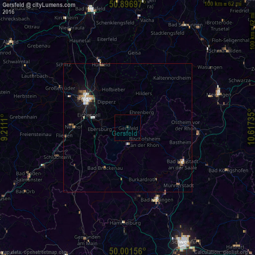
Analysis of Gersfeld night lights 2016
Square area 10x10 km:
 0%
0%90-99
0%80-89
0%70-79
0%60-69
0%50-59
0%40-49
0%30-39
0.56%20-29
0%10-19
0%0-9
99.44%Square area 50x50 km:
0.26%90-99
0.29%80-89
0.07%70-79
0.17%60-69
0.26%50-59
0.31%40-49
0.31%30-39
0.09%20-29
0.32%10-19
1.38%0-9
96.53%Clear (daylight) street map image can be seen on geolist.org.
Map coordinates:
50° 53' 49.1" North, 9° 12' 40" East
50° 27' 5" North, 9° 54' 51.2" East
50° 0' 5.6" North, 10° 37' 2.5" East
Some cities around Gersfeld sort by population:
• Fulda
20.2 km =12.6 mi,  303°
303°
• Künzell
17.3 km =10.7 mi,  306°
306°
• Neuhof
21 km =13 mi,  270°
270°
• Eichenzell
16.1 km =10 mi,  287°
287°
• Burkardroth
20.8 km =12.9 mi,  164°
164°
• Bad Brückenau
18.2 km =11.3 mi,  209°
209°
• Hofbieber
16 km =9.9 mi,  339°
339°
• Bischofsheim an der Rhön
8.6 km =5.3 mi,  129°
129°
2920926 (p: 6,351)
Sources (retrieved 2019-11-25):
» Earth at Night: Flat Maps 2012, 2016