Bad Königshofen im Grabfeld night lights from space
Night Light of Bad Königshofen im Grabfeld (Bavaria) from space (Germany) Src. Average luminocity for 10x10km area is 0.8476% and for 50x50km: 0.7992%.
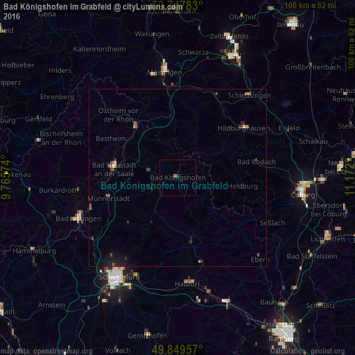
Analysis of Bad Königshofen im Grabfeld night lights 2016
Square area 10x10 km:
 0%
0%90-99
0%80-89
0%70-79
0%60-69
0.53%50-59
0.53%40-49
0%30-39
0%20-29
0.53%10-19
0%0-9
98.4%Square area 50x50 km:
0.02%90-99
0.05%80-89
0.02%70-79
0.1%60-69
0.12%50-59
0.22%40-49
0.19%30-39
0.16%20-29
0.23%10-19
0.78%0-9
98.11%Clear (daylight) street map image can be seen on geolist.org.
Map coordinates:
50° 44' 52.2" North, 9° 45' 56.7" East
50° 18' 3" North, 10° 28' 7.9" East
49° 50' 58.5" North, 11° 10' 19.2" East
Some cities around Bad Königshofen im Grabfeld sort by population:
• Bad Neustadt an der Saale
18.8 km =11.7 mi,  277°
277°
• Haßfurt
29.7 km =18.5 mi,  173°
173°
• Hildburghausen
23.2 km =14.4 mi,  53°
53°
• Münnerstadt
19.9 km =12.4 mi,  252°
252°
• Mellrichstadt
18.4 km =11.4 mi,  320°
320°
• Oerlenbach
29.2 km =18.1 mi,  234°
234°
• Hofheim in Unterfranken
18.6 km =11.6 mi, 168°
• Weitramsdorf
29.6 km =18.4 mi,  99°
99°
2885829 (p: 7,066)
Sources (retrieved 2019-11-25):
» Earth at Night: Flat Maps 2012, 2016