Maxdorf night lights from space
Night Light of Maxdorf (Rheinland-Pfalz) from space (Germany) Src. Average luminocity for 10x10km area is 19.3992% and for 50x50km: 21.5614%.
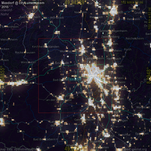
Analysis of Maxdorf night lights 2016
Square area 10x10 km:
 1.4%
1.4%90-99
2.52%80-89
0.14%70-79
2.1%60-69
3.5%50-59
1.82%40-49
2.94%30-39
2.66%20-29
12.75%10-19
21.85%0-9
48.32%Square area 50x50 km:
4.1%90-99
4.58%80-89
1.89%70-79
1.61%60-69
2.13%50-59
2.09%40-49
2.57%30-39
3.13%20-29
7.63%10-19
16.45%0-9
53.82%Clear (daylight) street map image can be seen on geolist.org.
Map coordinates:
49° 56' 33.7" North, 7° 35' 18.8" East
49° 29' 17" North, 8° 17' 30" East
49° 1' 45" North, 8° 59' 41.3" East
Some cities around Maxdorf sort by population:
• Frankenthal
6.8 km =4.2 mi,  41°
41°
• Bad Dürkheim
9.1 km =5.7 mi,  251°
251°
• Gartenstadt
8.7 km =5.4 mi,  111°
111°
• Mutterstadt
7 km =4.3 mi,  138°
138°
• Limburgerhof
10.1 km =6.3 mi,  134°
134°
• Herxheim am Berg
8.5 km =5.3 mi,  286°
286°
• Dannstadt-Schauernheim
5.5 km =3.4 mi,  167°
167°
• Lambsheim
2.9 km =1.8 mi,  354°
354°
2872686 (p: 6,882)
Sources (retrieved 2019-11-25):
» Earth at Night: Flat Maps 2012, 2016