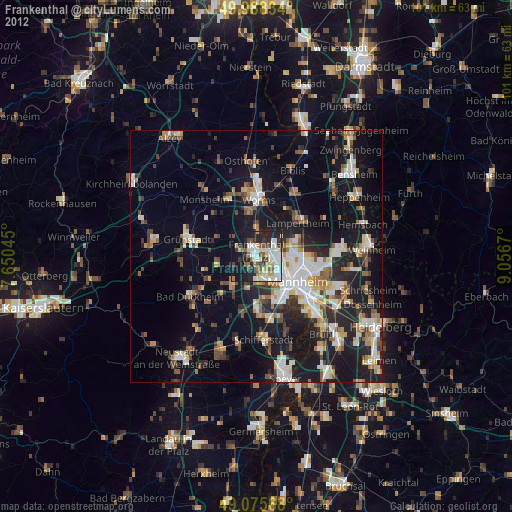
Frankenthal night lights from space
Night Light of Frankenthal (Rheinland-Pfalz) from space (Germany) Src. Average luminocity for 10x10km area is 48.8137% and for 50x50km: 23.5199%.
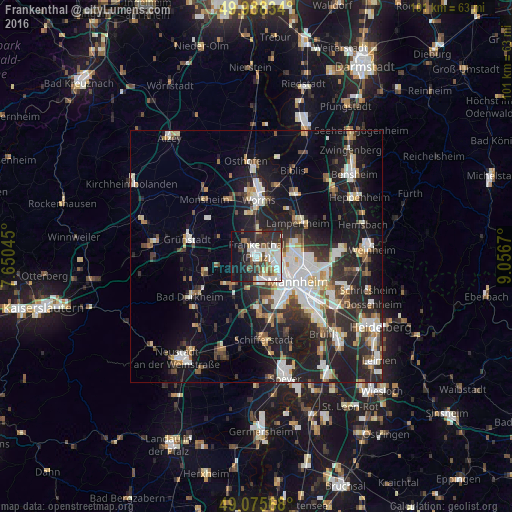
Analysis of Frankenthal night lights 2016
Square area 10x10 km:
 14.29%
90-99
12.75%80-89
2.94%70-79
2.8%60-69
5.04%50-59
4.06%40-49
4.34%30-39
8.82%20-29
15.97%10-19
18.77%0-9
10.22%Square area 50x50 km:
4.46%90-99
5.1%80-89
1.98%70-79
1.86%60-69
2.39%50-59
2.39%40-49
2.85%30-39
3.39%20-29
8.18%10-19
16.52%0-9
50.9%Clear (daylight) street map image can be seen on geolist.org.
Map coordinates:
49° 59' 18" North, 7° 39' 1.6" East
49° 32' 2.9" North, 8° 21' 12.9" East
49° 4' 32.4" North, 9° 3' 24.1" East
Some cities around Frankenthal sort by population:
• Mannheim
9.6 km =6 mi,  121°
121°
• Ludwigshafen am Rhein
8.9 km =5.5 mi,  131°
131°
• Gartenstadt
9.1 km =5.7 mi,  156°
156°
• Mutterstadt
10.3 km =6.4 mi,  178°
178°
• Bobenheim-Roxheim
5.9 km =3.7 mi,  2°
2°
• Dannstadt-Schauernheim
10.9 km =6.8 mi,  197°
197°
• Maxdorf
6.8 km =4.2 mi,  221°
221°
• Lambsheim
5.3 km =3.3 mi,  244°
244°
2925550 (p: 47,438)
Sources (retrieved 2019-11-25):
» Earth at Night: Flat Maps 2012, 2016