Dorsten night lights from space
Night Light of Dorsten (North Rhine-Westphalia) from space (Germany) Src. Average luminocity for 10x10km area is 19.4342% and for 50x50km: 31.8985%.
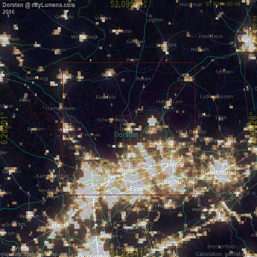
Analysis of Dorsten night lights 2016
Square area 10x10 km:
 1.12%
1.12%90-99
1.68%80-89
1.4%70-79
2.38%60-69
3.5%50-59
1.68%40-49
2.52%30-39
2.24%20-29
9.94%10-19
30.11%0-9
43.42%Square area 50x50 km:
7.07%90-99
7.28%80-89
4.04%70-79
4.31%60-69
4.92%50-59
4.27%40-49
3.27%30-39
3.07%20-29
4.35%10-19
8.64%0-9
48.79%Clear (daylight) street map image can be seen on geolist.org.
Map coordinates:
52° 5' 44.6" North, 6° 15' 43.2" East
51° 39' 42" North, 6° 57' 54.5" East
51° 13' 24.3" North, 7° 40' 5.7" East
Some cities around Dorsten sort by population:
• Recklinghausen
16.9 km =10.5 mi,  108°
108°
• Bottrop
15.5 km =9.6 mi,  189°
189°
• Marl
8.7 km =5.4 mi,  93°
93°
• Gladbeck
10.2 km =6.3 mi,  171°
171°
• Herten
14.3 km =8.9 mi,  120°
120°
• Klein Reken
15 km =9.3 mi,  21°
21°
• Schermbeck
7.2 km =4.5 mi,  289°
289°
• Raesfeld
14.1 km =8.8 mi,  325°
325°
2935530 (p: 79,981)
Sources (retrieved 2019-11-25):
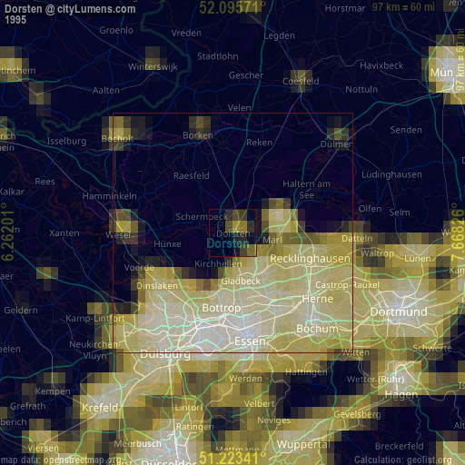
» NASA, Earths city lights 1995
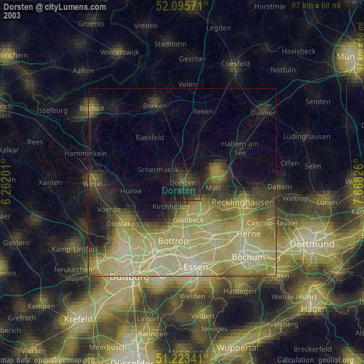
» NASA city lights 2003
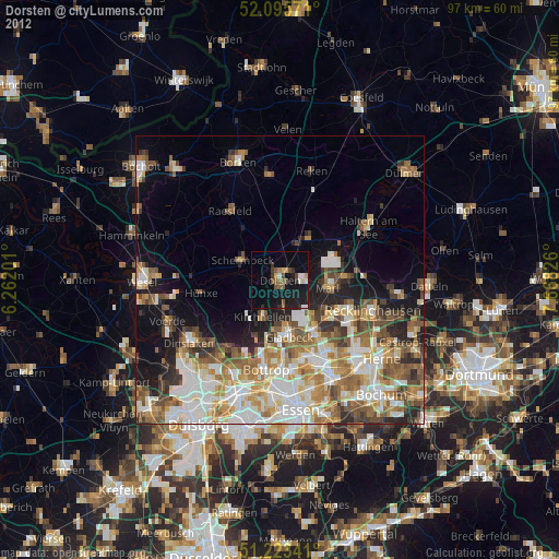
» Earth at Night: Flat Maps 2012, 2016