Märkisches Viertel night lights from space
Night Light of Märkisches Viertel (Berlin) from space (Germany) Src. Average luminocity for 10x10km area is 74.3558% and for 50x50km: 34.4446%.
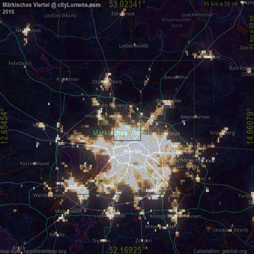
Analysis of Märkisches Viertel night lights 2016
Square area 10x10 km:
 24.74%
90-99
25.53%80-89
6.35%70-79
5.42%60-69
6.08%50-59
7.14%40-49
4.76%30-39
8.99%20-29
9.79%10-19
1.19%0-9
0%Square area 50x50 km:
10.41%90-99
8.9%80-89
3.48%70-79
2.8%60-69
2.97%50-59
3.13%40-49
3.45%30-39
4.01%20-29
6.38%10-19
10.93%0-9
43.54%Clear (daylight) street map image can be seen on geolist.org.
Map coordinates:
53° 1' 24.3" North, 12° 39' 16.3" East
52° 35' 54.3" North, 13° 21' 27.6" East
52° 10' 9.3" North, 14° 3' 38.8" East
Some cities around Märkisches Viertel sort by population:
• Reinickendorf
3.9 km =2.4 mi,  204°
204°
• Pankow
4.4 km =2.7 mi,  137°
137°
• Wittenau
2.5 km =1.6 mi,  256°
256°
• Niederschönhausen
3.4 km =2.1 mi,  116°
116°
• Hermsdorf
3.9 km =2.4 mi,  296°
296°
• Waidmannslust
2.7 km =1.7 mi,  290°
290°
• Rosenthal
1.4 km =0.9 mi,  83°
83°
• Wilhelmsruh
1.5 km =0.9 mi,  149°
149°
2873356 (p: 35,230)
Sources (retrieved 2019-11-25):
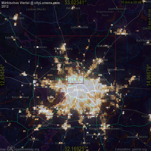
» Earth at Night: Flat Maps 2012, 2016