Rosenthal night lights from space
Night Light of Rosenthal (Berlin) from space (Germany) Src. Average luminocity for 10x10km area is 73.0013% and for 50x50km: 34.4247%.
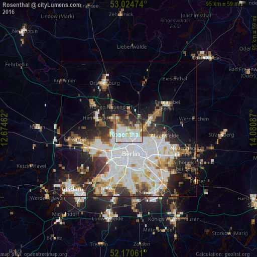
Analysis of Rosenthal night lights 2016
Square area 10x10 km:
 23.41%
90-99
24.87%80-89
7.14%70-79
5.56%60-69
5.69%50-59
6.22%40-49
5.03%30-39
8.6%20-29
12.17%10-19
1.32%0-9
0%Square area 50x50 km:
10.38%90-99
8.9%80-89
3.47%70-79
2.82%60-69
2.97%50-59
3.14%40-49
3.45%30-39
4%20-29
6.37%10-19
11.02%0-9
43.47%Clear (daylight) street map image can be seen on geolist.org.
Map coordinates:
53° 1' 29.1" North, 12° 40' 28.6" East
52° 35' 59.1" North, 13° 22' 39.9" East
52° 10' 14.2" North, 14° 4' 51.1" East
Some cities around Rosenthal sort by population:
• Reinickendorf
4.7 km =2.9 mi,  219°
219°
• Pankow
3.8 km =2.4 mi,  154°
154°
• Märkisches Viertel
1.4 km =0.9 mi,  263°
263°
• Wittenau
3.9 km =2.4 mi, 259°
• Niederschönhausen
2.4 km =1.5 mi,  134°
134°
• Französisch Buchholz
3.6 km =2.2 mi,  85°
85°
• Waidmannslust
4 km =2.5 mi,  281°
281°
• Wilhelmsruh
1.5 km =0.9 mi,  203°
203°
2844910 (p: 8,992)
Sources (retrieved 2019-11-25):
» Earth at Night: Flat Maps 2012, 2016