Ludwigsburg night lights from space
Night Light of Ludwigsburg (Baden-Württemberg) from space (Germany) Src. Average luminocity for 10x10km area is 64.2614% and for 50x50km: 26.3224%.
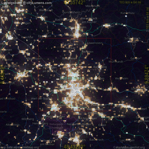
Analysis of Ludwigsburg night lights 2016
Square area 10x10 km:
 12.93%
90-99
18.32%80-89
7.53%70-79
5.54%60-69
9.66%50-59
5.82%40-49
10.65%30-39
17.05%20-29
12.22%10-19
0.28%0-9
0%Square area 50x50 km:
4.43%90-99
5%80-89
2.18%70-79
2.92%60-69
3.55%50-59
3.32%40-49
3.78%30-39
4.12%20-29
8.39%10-19
15.55%0-9
46.75%Clear (daylight) street map image can be seen on geolist.org.
Map coordinates:
49° 21' 26.7" North, 8° 29' 18.6" East
48° 53' 50.3" North, 9° 11' 29.8" East
48° 25' 58.5" North, 9° 53' 41.1" East
Some cities around Ludwigsburg sort by population:
• Kornwestheim
4 km =2.5 mi,  186°
186°
• Stuttgart Mühlhausen
6.7 km =4.2 mi,  155°
155°
• Freiberg am Neckar
3.9 km =2.4 mi,  11°
11°
• Asperg
4.2 km =2.6 mi,  282°
282°
• Tamm
6.1 km =3.8 mi,  294°
294°
• Möglingen
4.9 km =3 mi,  256°
256°
• Pleidelsheim
6.9 km =4.3 mi, 6°
• Benningen am Neckar
6.6 km =4.1 mi,  33°
33°
2875392 (p: 87,603)
Sources (retrieved 2019-11-25):
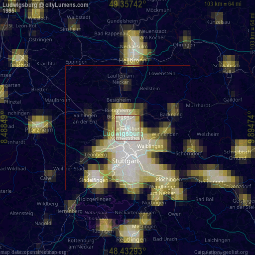
» NASA, Earths city lights 1995
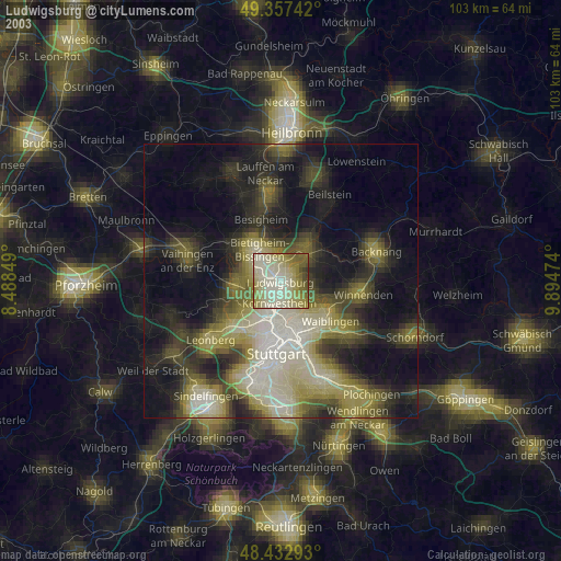
» NASA city lights 2003
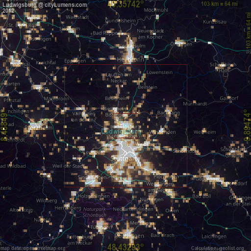
» Earth at Night: Flat Maps 2012, 2016