Lößnitz night lights from space
Night Light of Lößnitz (Saxony) from space (Germany) Src. Average luminocity for 10x10km area is 9.3904% and for 50x50km: 7.7573%.
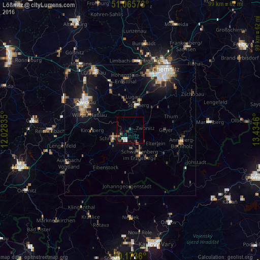
Analysis of Lößnitz night lights 2016
Square area 10x10 km:
 1.6%
1.6%90-99
1.2%80-89
0.94%70-79
1.6%60-69
0.4%50-59
1.07%40-49
0.94%30-39
1.47%20-29
0.94%10-19
1.47%0-9
88.37%Square area 50x50 km:
1.07%90-99
1.37%80-89
0.78%70-79
0.73%60-69
1.05%50-59
1.21%40-49
0.96%30-39
0.88%20-29
1.66%10-19
5.28%0-9
85.01%Clear (daylight) street map image can be seen on geolist.org.
Map coordinates:
51° 3' 56.8" North, 12° 1' 42.1" East
50° 37' 18.5" North, 12° 43' 53.3" East
50° 10' 25" North, 13° 26' 4.6" East
Some cities around Lößnitz sort by population:
• Aue
3.9 km =2.4 mi,  206°
206°
• Schwarzenberg
10.1 km =6.3 mi,  157°
157°
• Schneeberg
7 km =4.3 mi,  244°
244°
• Zwönitz
5.6 km =3.5 mi,  80°
80°
• Zschorlau
8.4 km =5.2 mi,  223°
223°
• Bad Schlema
4.7 km =2.9 mi, 242°
• Hartenstein
6.3 km =3.9 mi,  315°
315°
• Lauter
6.6 km =4.1 mi,  177°
177°
2875799 (p: 10,433)
Sources (retrieved 2019-11-25):
» Earth at Night: Flat Maps 2012, 2016