Lauter night lights from space
Night Light of Lauter (Saxony) from space (Germany) Src. Average luminocity for 10x10km area is 14.2286% and for 50x50km: 4.5652%.
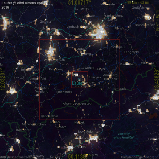
Analysis of Lauter night lights 2016
Square area 10x10 km:
 1.87%
1.87%90-99
1.47%80-89
1.47%70-79
1.6%60-69
2.67%50-59
2.81%40-49
1.74%30-39
0.67%20-29
2.27%10-19
1.6%0-9
81.82%Square area 50x50 km:
0.4%90-99
0.5%80-89
0.38%70-79
0.44%60-69
0.64%50-59
0.87%40-49
0.8%30-39
0.6%20-29
1.15%10-19
3.74%0-9
90.49%Clear (daylight) street map image can be seen on geolist.org.
Map coordinates:
51° 0' 25.8" North, 12° 1' 55.2" East
50° 33' 45.5" North, 12° 44' 6.5" East
50° 6' 49.9" North, 13° 26' 17.7" East
Some cities around Lauter sort by population:
• Aue
3.7 km =2.3 mi,  326°
326°
• Schwarzenberg
4.5 km =2.8 mi,  127°
127°
• Schneeberg
7.5 km =4.7 mi,  298°
298°
• Zwönitz
9.2 km =5.7 mi,  35°
35°
• Lößnitz
6.6 km =4.1 mi,  357°
357°
• Zschorlau
6 km =3.7 mi,  274°
274°
• Bad Schlema
6.2 km =3.9 mi,  315°
315°
• Hartenstein
12 km =7.5 mi,  337°
337°
2879964 (p: 5,028)
Sources (retrieved 2019-11-25):
» Earth at Night: Flat Maps 2012, 2016