Lilienthal night lights from space
Night Light of Lilienthal (Lower Saxony) from space (Germany) Src. Average luminocity for 10x10km area is 19.346% and for 50x50km: 9.5635%.
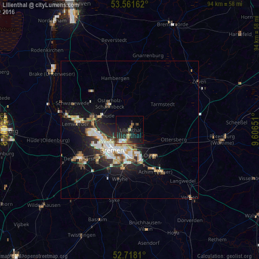
Analysis of Lilienthal night lights 2016
Square area 10x10 km:
 1.89%
1.89%90-99
2.15%80-89
1.77%70-79
1.64%60-69
3.03%50-59
2.9%40-49
2.27%30-39
2.4%20-29
12.88%10-19
18.94%0-9
50.13%Square area 50x50 km:
1.63%90-99
2.02%80-89
0.83%70-79
1.04%60-69
1.18%50-59
0.85%40-49
1.33%30-39
1.03%20-29
3.06%10-19
6.6%0-9
80.42%Clear (daylight) street map image can be seen on geolist.org.
Map coordinates:
53° 33' 41.8" North, 8° 12' 0.9" East
53° 8' 30.9" North, 8° 54' 12.2" East
52° 43' 5.2" North, 9° 36' 23.4" East
Some cities around Lilienthal sort by population:
• Bremen
9.8 km =6.1 mi,  220°
220°
• Burglesum
14.5 km =9 mi,  280°
280°
• Stuhr
15.8 km =9.8 mi, 220°
• Osterholz-Scharmbeck
11.9 km =7.4 mi,  322°
322°
• Oyten
12.7 km =7.9 mi,  143°
143°
• Ritterhude
12.1 km =7.5 mi,  292°
292°
• Worpswede
8.5 km =5.3 mi,  13°
13°
• Grasberg
7 km =4.3 mi,  49°
49°
2877709 (p: 18,293)
Sources (retrieved 2019-11-25):
» Earth at Night: Flat Maps 2012, 2016