Burglesum night lights from space
Night Light of Burglesum (Bremen) from space (Germany) Src. Average luminocity for 10x10km area is 37.0051% and for 50x50km: 9.7111%.
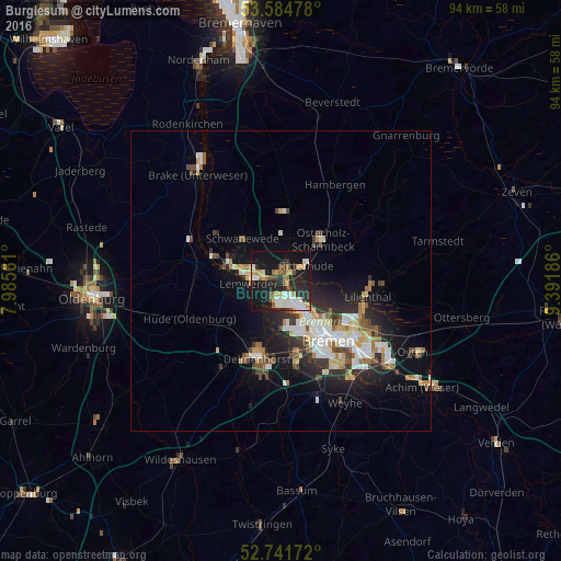
Analysis of Burglesum night lights 2016
Square area 10x10 km:
 5.93%
5.93%90-99
7.95%80-89
3.66%70-79
5.05%60-69
5.05%50-59
1.77%40-49
4.8%30-39
2.4%20-29
15.28%10-19
35.48%0-9
12.63%Square area 50x50 km:
1.66%90-99
2.09%80-89
0.81%70-79
1.02%60-69
1.18%50-59
0.87%40-49
1.4%30-39
1.03%20-29
3.08%10-19
6.6%0-9
80.25%Clear (daylight) street map image can be seen on geolist.org.
Map coordinates:
53° 35' 5.2" North, 7° 59' 8.2" East
53° 9' 55.2" North, 8° 41' 19.4" East
52° 44' 30.2" North, 9° 23' 30.7" East
Some cities around Burglesum sort by population:
• Bremen
12.8 km =8 mi,  141°
141°
• Delmenhorst
13.3 km =8.3 mi,  196°
196°
• Vegesack
4.8 km =3 mi,  271°
271°
• Osterholz-Scharmbeck
9.9 km =6.2 mi,  45°
45°
• Schwanewede
9.6 km =6 mi,  321°
321°
• Lilienthal
14.5 km =9 mi,  100°
100°
• Ritterhude
3.7 km =2.3 mi,  57°
57°
• Lemwerder
4.8 km =3 mi, 271°
11594317 (p: 33,000)
Sources (retrieved 2019-11-25):
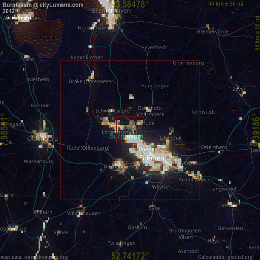
» Earth at Night: Flat Maps 2012, 2016