Korntal night lights from space
Night Light of Korntal (Baden-Württemberg) from space (Germany) Src. Average luminocity for 10x10km area is 66.3324% and for 50x50km: 28.6197%.
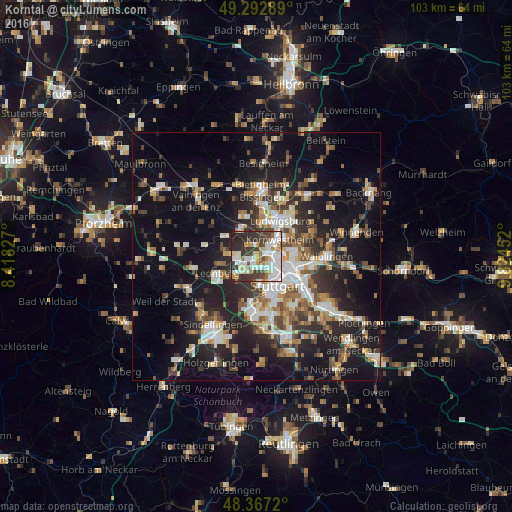
Analysis of Korntal night lights 2016
Square area 10x10 km:
 19.46%
90-99
19.46%80-89
5.82%70-79
6.53%60-69
5.68%50-59
3.41%40-49
8.95%30-39
15.77%20-29
13.07%10-19
1.85%0-9
0%Square area 50x50 km:
4.53%90-99
5.38%80-89
2.4%70-79
3.17%60-69
3.9%50-59
3.5%40-49
4.08%30-39
4.49%20-29
9.25%10-19
19.51%0-9
39.8%Clear (daylight) street map image can be seen on geolist.org.
Map coordinates:
49° 17' 34.4" North, 8° 25' 5.8" East
48° 49' 55.8" North, 9° 7' 17" East
48° 22' 1.9" North, 9° 49' 28.3" East
Some cities around Korntal sort by population:
• Stuttgart
6.9 km =4.3 mi,  143°
143°
• Kornwestheim
5.7 km =3.5 mi,  55°
55°
• Stuttgart Feuerbach
3.7 km =2.3 mi,  134°
134°
• Ditzingen
4 km =2.5 mi,  261°
261°
• Gerlingen
5.6 km =3.5 mi,  229°
229°
• Schwieberdingen
6 km =3.7 mi,  325°
325°
• Möglingen
6.2 km =3.9 mi,  3°
3°
• Hemmingen
7.5 km =4.7 mi,  300°
300°
2885412 (p: 18,081)
Sources (retrieved 2019-11-25):
» Earth at Night: Flat Maps 2012, 2016