Ditzingen night lights from space
Night Light of Ditzingen (Baden-Württemberg) from space (Germany) Src. Average luminocity for 10x10km area is 49.7756% and for 50x50km: 28.533%.
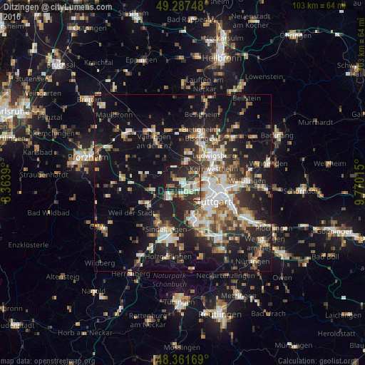
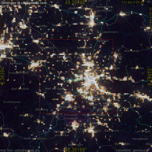
Analysis of Ditzingen night lights 2016
Square area 10x10 km:
 9.09%
9.09%90-99
12.78%80-89
4.12%70-79
5.68%60-69
5.11%50-59
4.12%40-49
5.97%30-39
14.49%20-29
22.02%10-19
15.06%0-9
1.56%Square area 50x50 km:
4.52%90-99
5.27%80-89
2.41%70-79
3.21%60-69
3.99%50-59
3.61%40-49
3.92%30-39
4.38%20-29
9.17%10-19
19.54%0-9
39.98%Clear (daylight) street map image can be seen on geolist.org.
Map coordinates:
49° 17' 14.9" North, 8° 21' 50" East
48° 49' 36.2" North, 9° 4' 1.3" East
48° 21' 42.1" North, 9° 46' 12.5" East
Some cities around Ditzingen sort by population:
• Leonberg
4.7 km =2.9 mi,  231°
231°
• Stuttgart Feuerbach
6.9 km =4.3 mi,  106°
106°
• Gerlingen
3 km =1.9 mi,  185°
185°
• Korntal
4 km =2.5 mi,  81°
81°
• Markgröningen
8.8 km =5.5 mi,  6°
6°
• Schwieberdingen
5.6 km =3.5 mi, 5°
• Möglingen
8 km =5 mi,  33°
33°
• Hemmingen
5.1 km =3.2 mi,  330°
330°
2936705 (p: 24,149)
Sources (retrieved 2019-11-25):
» Earth at Night: Flat Maps 2012, 2016