Stuttgart night lights from space
Night Light of Stuttgart (Baden-Württemberg) from space (Germany) Src. Average luminocity for 10x10km area is 83.4063% and for 50x50km: 28.709%.
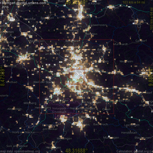
Analysis of Stuttgart night lights 2016
Square area 10x10 km:
 30.68%
90-99
27.7%80-89
5.97%70-79
7.39%60-69
10.8%50-59
6.82%40-49
8.81%30-39
1.85%20-29
0%10-19
0%0-9
0%Square area 50x50 km:
4.52%90-99
5.33%80-89
2.35%70-79
3.13%60-69
3.99%50-59
3.56%40-49
4.03%30-39
4.51%20-29
9.38%10-19
19.93%0-9
39.27%Clear (daylight) street map image can be seen on geolist.org.
Map coordinates:
49° 14' 36.6" North, 8° 28' 26" East
48° 46' 56.4" North, 9° 10' 37.3" East
48° 19' 0.8" North, 9° 52' 48.5" East
Some cities around Stuttgart sort by population:
• Esslingen
10.5 km =6.5 mi,  116°
116°
• Fellbach
7.9 km =4.9 mi,  67°
67°
• Leinfelden-Echterdingen
9.8 km =6.1 mi,  183°
183°
• Ostfildern
8.1 km =5 mi,  139°
139°
• Kornwestheim
8.8 km =5.5 mi,  4°
4°
• Ditzingen
9.4 km =5.8 mi,  301°
301°
• Gerlingen
8.6 km =5.3 mi,  282°
282°
• Korntal
6.9 km =4.3 mi,  323°
323°
2825297 (p: 589,793)
Sources (retrieved 2019-11-25):
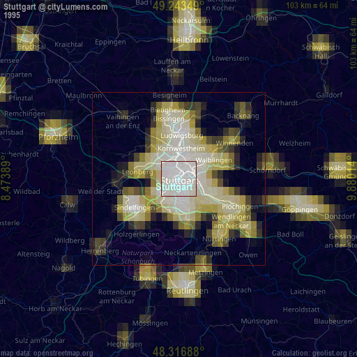
» NASA, Earths city lights 1995
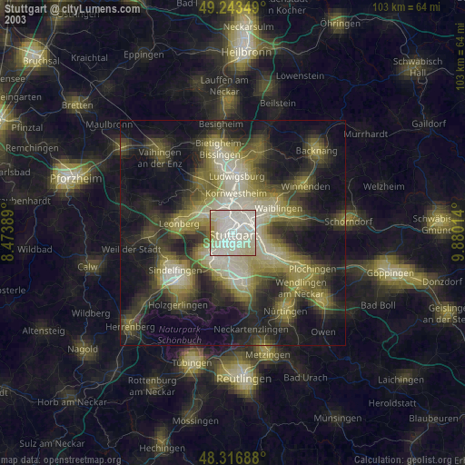
» NASA city lights 2003
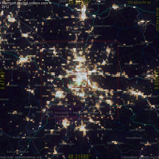
» Earth at Night: Flat Maps 2012, 2016