Klingenberg am Main night lights from space
Night Light of Klingenberg am Main (Bavaria) from space (Germany) Src. Average luminocity for 10x10km area is 2.9412% and for 50x50km: 4.5465%.
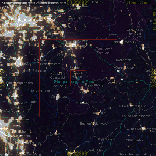
Analysis of Klingenberg am Main night lights 2016
Square area 10x10 km:
 0%
0%90-99
0%80-89
0%70-79
0.4%60-69
0.8%50-59
1.47%40-49
0%30-39
0%20-29
0.13%10-19
0.4%0-9
96.79%Square area 50x50 km:
0.45%90-99
0.56%80-89
0.44%70-79
0.44%60-69
0.95%50-59
0.63%40-49
0.87%30-39
0.47%20-29
0.77%10-19
2.98%0-9
91.44%Clear (daylight) street map image can be seen on geolist.org.
Map coordinates:
50° 14' 12.9" North, 8° 28' 37.7" East
49° 47' 6.3" North, 9° 10' 48.9" East
49° 19' 44.3" North, 9° 53' 0.2" East
Some cities around Klingenberg am Main sort by population:
• Erlenbach am Main
2.4 km =1.5 mi,  328°
328°
• Höchst im Odenwald
13.1 km =8.1 mi,  277°
277°
• Miltenberg
10.9 km =6.8 mi,  145°
145°
• Obernburg am Main
6.7 km =4.2 mi, 327°
• Elsenfeld
6.5 km =4 mi,  349°
349°
• Kleinwallstadt
10 km =6.2 mi,  355°
355°
• Großheubach
7 km =4.3 mi, 154°
• Mömlingen
10.8 km =6.7 mi,  320°
320°
2887736 (p: 6,294)
Sources (retrieved 2019-11-25):
» Earth at Night: Flat Maps 2012, 2016