Karlsruhe night lights from space
Night Light of Karlsruhe (Baden-Württemberg) from space (Germany) Src. Average luminocity for 10x10km area is 68.2545% and for 50x50km: 18.7854%.
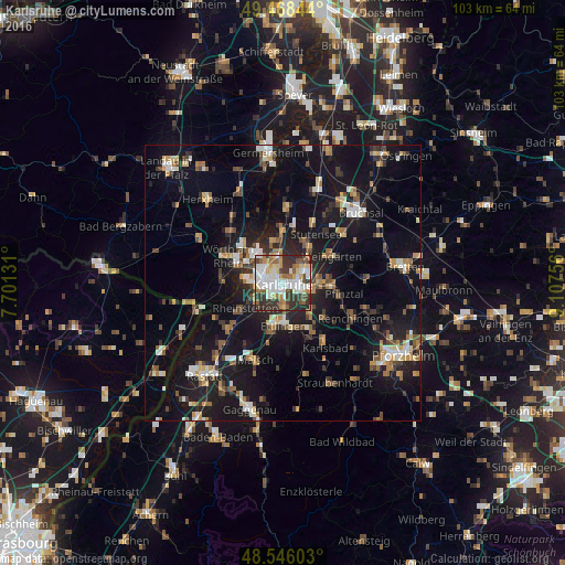

Analysis of Karlsruhe night lights 2016
Square area 10x10 km:
 16.67%
90-99
19.35%80-89
9.52%70-79
6.4%60-69
6.99%50-59
8.63%40-49
5.06%30-39
18.75%20-29
8.63%10-19
0%0-9
0%Square area 50x50 km:
2.09%90-99
2.91%80-89
1.68%70-79
2.17%60-69
2.34%50-59
2.36%40-49
2.66%30-39
2.83%20-29
4.67%10-19
19.96%0-9
56.34%Clear (daylight) street map image can be seen on geolist.org.
Map coordinates:
49° 28' 6.4" North, 7° 42' 4.7" East
49° 0' 33.7" North, 8° 24' 16" East
48° 32' 45.7" North, 9° 6' 27.2" East
Some cities around Karlsruhe sort by population:
• Ettlingen
7.6 km =4.7 mi,  178°
178°
• Rheinstetten
8.4 km =5.2 mi,  237°
237°
• Wörth am Rhein
11.4 km =7.1 mi,  292°
292°
• Eggenstein-Leopoldshafen
9 km =5.6 mi,  357°
357°
• Durmersheim
13.1 km =8.1 mi,  229°
229°
• Weingarten
10.2 km =6.3 mi,  60°
60°
• Hagenbach
11.3 km =7 mi,  274°
274°
• Jöhlingen
12.6 km =7.8 mi,  78°
78°
2892794 (p: 283,799)
Sources (retrieved 2019-11-25):
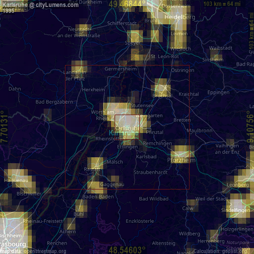
» NASA, Earths city lights 1995
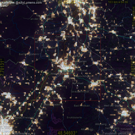
» NASA city lights 2003
» Earth at Night: Flat Maps 2012, 2016