Ilsenburg night lights from space
Night Light of Ilsenburg (Saxony-Anhalt) from space (Germany) Src. Average luminocity for 10x10km area is 5.7715% and for 50x50km: 2.3909%.
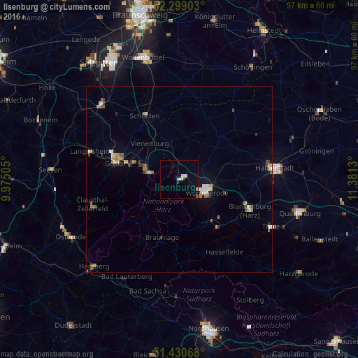
Analysis of Ilsenburg night lights 2016
Square area 10x10 km:
 0.38%
0.38%90-99
1.89%80-89
0.63%70-79
0.38%60-69
0.25%50-59
0.51%40-49
0%30-39
1.01%20-29
0%10-19
1.52%0-9
93.43%Square area 50x50 km:
0.25%90-99
0.39%80-89
0.19%70-79
0.33%60-69
0.36%50-59
0.41%40-49
0.2%30-39
0.37%20-29
0.16%10-19
0.65%0-9
96.68%Clear (daylight) street map image can be seen on geolist.org.
Map coordinates:
52° 17' 56.5" North, 9° 58' 30.2" East
51° 52' 1" North, 10° 40' 41.4" East
51° 25' 50.4" North, 11° 22' 52.7" East
Some cities around Ilsenburg sort by population:
• Goslar
17.7 km =11 mi,  283°
283°
• Wernigerode
7.9 km =4.9 mi,  115°
115°
• Bad Harzburg
8.2 km =5.1 mi, 282°
• Blankenburg
20.9 km =13 mi,  114°
114°
• Vienenburg
12.3 km =7.6 mi,  320°
320°
• Huy-Neinstedt
19.6 km =12.2 mi,  55°
55°
• Schladen
19.7 km =12.2 mi,  331°
331°
• Braunlage
16.3 km =10.1 mi,  196°
196°
2896483 (p: 6,326)
Sources (retrieved 2019-11-25):
» Earth at Night: Flat Maps 2012, 2016