Vienenburg night lights from space
Night Light of Vienenburg (Lower Saxony) from space (Germany) Src. Average luminocity for 10x10km area is 1.5013% and for 50x50km: 3.7421%.
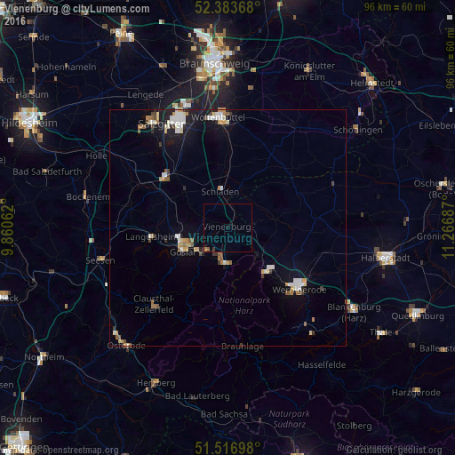
Analysis of Vienenburg night lights 2016
Square area 10x10 km:
 0%
0%90-99
0%80-89
0%70-79
0.38%60-69
0.13%50-59
0.51%40-49
0%30-39
0.51%20-29
0.25%10-19
1.01%0-9
97.22%Square area 50x50 km:
0.56%90-99
0.7%80-89
0.33%70-79
0.54%60-69
0.39%50-59
0.46%40-49
0.29%30-39
0.33%20-29
0.37%10-19
2.43%0-9
93.6%Clear (daylight) street map image can be seen on geolist.org.
Map coordinates:
52° 23' 1.2" North, 9° 51' 38.2" East
51° 57' 8.7" North, 10° 33' 49.5" East
51° 31' 1.1" North, 11° 16' 0.7" East
Some cities around Vienenburg sort by population:
• Goslar
10.8 km =6.7 mi,  240°
240°
• Wernigerode
19.8 km =12.3 mi,  130°
130°
• Bad Harzburg
7.8 km =4.8 mi,  181°
181°
• Clausthal-Zellerfeld
22.2 km =13.8 mi,  224°
224°
• Langelsheim
15.9 km =9.9 mi,  264°
264°
• Liebenburg
11.9 km =7.4 mi,  310°
310°
• Ilsenburg
12.3 km =7.6 mi,  140°
140°
• Schladen
7.9 km =4.9 mi,  348°
348°
2817394 (p: 11,417)
Sources (retrieved 2019-11-25):
» Earth at Night: Flat Maps 2012, 2016