Huy-Neinstedt night lights from space
Night Light of Huy-Neinstedt (Saxony-Anhalt) from space (Germany) Src. Average luminocity for 10x10km area is 0.1806% and for 50x50km: 2.6023%.
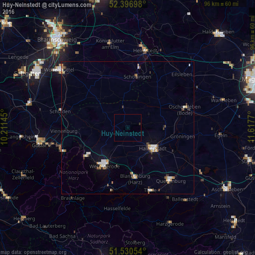
Analysis of Huy-Neinstedt night lights 2016
Square area 10x10 km:
 0%
0%90-99
0%80-89
0%70-79
0%60-69
0%50-59
0%40-49
0%30-39
0.51%20-29
0%10-19
0%0-9
99.49%Square area 50x50 km:
0.36%90-99
0.49%80-89
0.28%70-79
0.33%60-69
0.24%50-59
0.25%40-49
0.26%30-39
0.44%20-29
0.08%10-19
0.91%0-9
96.35%Clear (daylight) street map image can be seen on geolist.org.
Map coordinates:
52° 23' 49.1" North, 10° 12' 41.2" East
51° 57' 57.1" North, 10° 54' 52.5" East
51° 31' 49.9" North, 11° 37' 3.7" East
Some cities around Huy-Neinstedt sort by population:
• Halberstadt
12.5 km =7.8 mi,  128°
128°
• Wernigerode
17 km =10.6 mi,  212°
212°
• Oschersleben
22.7 km =14.1 mi,  71°
71°
• Blankenburg
19.7 km =12.2 mi,  171°
171°
• Schöningen
19.5 km =12.1 mi,  10°
10°
• Vienenburg
24.1 km =15 mi,  266°
266°
• Ilsenburg
19.6 km =12.2 mi,  235°
235°
• Schöppenstedt
21.9 km =13.6 mi,  334°
334°
2896834 (p: 8,797)
Sources (retrieved 2019-11-25):
» Earth at Night: Flat Maps 2012, 2016