Hockenheim night lights from space
Night Light of Hockenheim (Baden-Württemberg) from space (Germany) Src. Average luminocity for 10x10km area is 28.8396% and for 50x50km: 23.2122%.
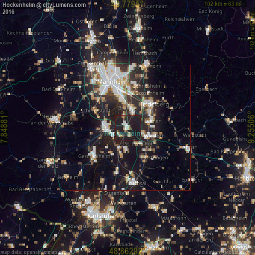
Analysis of Hockenheim night lights 2016
Square area 10x10 km:
 2.94%
2.94%90-99
4.14%80-89
2.01%70-79
2.14%60-69
2.81%50-59
3.61%40-49
2.01%30-39
1.6%20-29
14.44%10-19
64.3%0-9
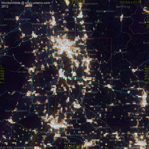
0%Square area 50x50 km:
4.44%90-99
4.88%80-89
1.88%70-79
1.79%60-69
2.41%50-59
2.26%40-49
2.81%30-39
3.34%20-29
7.76%10-19
18.93%0-9
49.51%Clear (daylight) street map image can be seen on geolist.org.
Map coordinates:
49° 46' 46.2" North, 7° 50' 55.7" East
49° 19' 24" North, 8° 33' 7" East
48° 51' 46.5" North, 9° 15' 18.2" East
Some cities around Hockenheim sort by population:
• Schwetzingen
6.9 km =4.3 mi,  18°
18°
• Walldorf
6.8 km =4.2 mi,  106°
106°
• Ketsch
5.2 km =3.2 mi,  343°
343°
• Sankt Leon-Rot
8 km =5 mi,  143°
143°
• Oftersheim
5.2 km =3.2 mi,  25°
25°
• Reilingen
2.9 km =1.8 mi,  162°
162°
• Neulußheim
3.7 km =2.3 mi,  220°
220°
• Altlußheim
4.5 km =2.8 mi,  237°
237°
2902852 (p: 20,614)
Sources (retrieved 2019-11-25):
» Earth at Night: Flat Maps 2012, 2016