Ketsch night lights from space
Night Light of Ketsch (Baden-Württemberg) from space (Germany) Src. Average luminocity for 10x10km area is 35.123% and for 50x50km: 23.6072%.
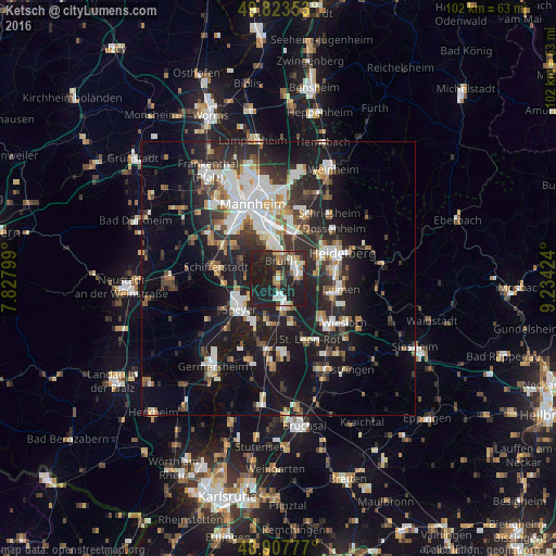
Analysis of Ketsch night lights 2016
Square area 10x10 km:
 4.55%
4.55%90-99
6.68%80-89
2.67%70-79
2.54%60-69
4.01%50-59
3.88%40-49
2.81%30-39
3.34%20-29
25.8%10-19
43.72%0-9
0%Square area 50x50 km:
4.37%90-99
4.84%80-89
1.86%70-79
1.76%60-69
2.42%50-59
2.46%40-49
2.84%30-39
3.62%20-29
8.94%10-19
19.63%0-9
47.25%Clear (daylight) street map image can be seen on geolist.org.
Map coordinates:
49° 49' 24.7" North, 7° 49' 40.8" East
49° 22' 4" North, 8° 31' 52" East
48° 54' 28" North, 9° 14' 3.3" East
Some cities around Ketsch sort by population:
• Schwetzingen
4 km =2.5 mi,  66°
66°
• Hockenheim
5.2 km =3.2 mi,  163°
163°
• Brühl
3.3 km =2.1 mi,  3°
3°
• Oftersheim
3.8 km =2.4 mi,  94°
94°
• Plankstadt
5.6 km =3.5 mi,  57°
57°
• Neulußheim
7.8 km =4.8 mi,  186°
186°
• Waldsee
7.3 km =4.5 mi,  294°
294°
• Altlußheim
7.7 km =4.8 mi,  197°
197°
2891343 (p: 13,124)
Sources (retrieved 2019-11-25):
» Earth at Night: Flat Maps 2012, 2016