Hirschaid night lights from space
Night Light of Hirschaid (Bavaria) from space (Germany) Src. Average luminocity for 10x10km area is 7.1872% and for 50x50km: 4.7362%.
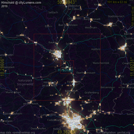
Analysis of Hirschaid night lights 2016
Square area 10x10 km:
 0.53%
0.53%90-99
0.4%80-89
0.67%70-79
0.27%60-69
2.01%50-59
1.07%40-49
2.41%30-39
0.4%20-29
1.07%10-19
3.88%0-9
87.3%Square area 50x50 km:
0.67%90-99
0.77%80-89
0.48%70-79
0.26%60-69
0.46%50-59
0.61%40-49
0.72%30-39
0.57%20-29
1.36%10-19
4.18%0-9
89.92%Clear (daylight) street map image can be seen on geolist.org.
Map coordinates:
50° 16' 9.9" North, 10° 17' 9.8" East
49° 49' 4.4" North, 10° 59' 21" East
49° 21' 43.5" North, 11° 41' 32.3" East
Some cities around Hirschaid sort by population:
• Bamberg
11 km =6.8 mi,  324°
324°
• Forchheim
12.2 km =7.6 mi,  155°
155°
• Memmelsdorf
12.7 km =7.9 mi,  350°
350°
• Strullendorf
3.2 km =2 mi,  337°
337°
• Stegaurach
11.7 km =7.3 mi,  296°
296°
• Eggolsheim
7.2 km =4.5 mi,  137°
137°
• Litzendorf
10.8 km =6.7 mi,  8°
8°
• Heroldsbach
13.9 km =8.6 mi,  177°
177°
2903810 (p: 11,508)
Sources (retrieved 2019-11-25):
» Earth at Night: Flat Maps 2012, 2016