Litzendorf night lights from space
Night Light of Litzendorf (Bavaria) from space (Germany) Src. Average luminocity for 10x10km area is 2.4188% and for 50x50km: 3.4526%.
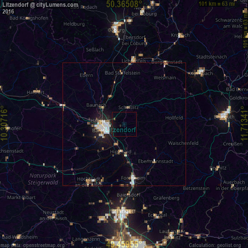
Analysis of Litzendorf night lights 2016
Square area 10x10 km:
 0%
0%90-99
0%80-89
0%70-79
0%60-69
0%50-59
0.56%40-49
0%30-39
0%20-29
0.56%10-19
7.7%0-9
91.18%Square area 50x50 km:
0.56%90-99
0.65%80-89
0.19%70-79
0.23%60-69
0.38%50-59
0.46%40-49
0.58%30-39
0.38%20-29
0.87%10-19
2.65%0-9
93.05%Clear (daylight) street map image can be seen on geolist.org.
Map coordinates:
50° 21' 54.3" North, 10° 18' 25.8" East
49° 54' 52" North, 11° 0' 37" East
49° 27' 34.4" North, 11° 42' 48.3" East
Some cities around Litzendorf sort by population:
• Bamberg
8 km =5 mi,  257°
257°
• Hirschaid
10.8 km =6.7 mi,  188°
188°
• Memmelsdorf
4.1 km =2.5 mi,  295°
295°
• Hallstadt
9.8 km =6.1 mi,  279°
279°
• Strullendorf
8.3 km =5.2 mi,  199°
199°
• Scheßlitz
7 km =4.3 mi,  13°
13°
• Bischberg
12.8 km =8 mi,  268°
268°
• Zapfendorf
12.8 km =8 mi,  334°
334°
2876787 (p: 6,101)
Sources (retrieved 2019-11-25):
» Earth at Night: Flat Maps 2012, 2016