Hildburghausen night lights from space
Night Light of Hildburghausen (Thuringia) from space (Germany) Src. Average luminocity for 10x10km area is 2.1611% and for 50x50km: 2.1771%.
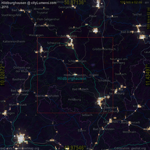
Analysis of Hildburghausen night lights 2016
Square area 10x10 km:
 0%
0%90-99
0.56%80-89
0%70-79
0.42%60-69
0.14%50-59
0.56%40-49
0.14%30-39
1.26%20-29
0.84%10-19
0%0-9
96.08%Square area 50x50 km:
0.23%90-99
0.42%80-89
0.26%70-79
0.18%60-69
0.22%50-59
0.35%40-49
0.26%30-39
0.16%20-29
0.3%10-19
1.59%0-9
96.02%Clear (daylight) street map image can be seen on geolist.org.
Map coordinates:
50° 52' 16.9" North, 10° 1' 43.4" East
50° 25' 31.9" North, 10° 43' 54.6" East
49° 58' 31.7" North, 11° 26' 5.9" East
Some cities around Hildburghausen sort by population:
• Suhl
20.6 km =12.8 mi,  352°
352°
• Coburg
24.7 km =15.3 mi,  138°
138°
• Rödental
26.3 km =16.3 mi,  123°
123°
• Zella-Mehlis
26.2 km =16.3 mi, 348°
• Bad Königshofen im Grabfeld
23.2 km =14.4 mi,  233°
233°
• Eisfeld
12.4 km =7.7 mi,  89°
89°
• Schleusingen
9.6 km =6 mi,  10°
10°
• Weitramsdorf
21.6 km =13.4 mi,  150°
150°
2904804 (p: 12,171)
Sources (retrieved 2019-11-25):
» Earth at Night: Flat Maps 2012, 2016