Achern night lights from space
Night Light of Achern (Baden-Württemberg) from space (Germany) Src. Average luminocity for 10x10km area is 14.9539% and for 50x50km: 14.3459%.
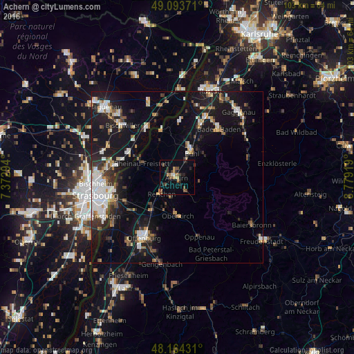
Analysis of Achern night lights 2016
Square area 10x10 km:
 0.45%
0.45%90-99
0.74%80-89
0.6%70-79
2.53%60-69
2.23%50-59
3.87%40-49
3.13%30-39
3.13%20-29
4.32%10-19
4.76%0-9
74.26%Square area 50x50 km:
2.7%90-99
2.37%80-89
1.16%70-79
1.27%60-69
1.42%50-59
1.53%40-49
1.5%30-39
2.05%20-29
3.45%10-19
14.55%0-9
68.01%Clear (daylight) street map image can be seen on geolist.org.
Map coordinates:
49° 5' 37.4" North, 7° 22' 22.6" East
48° 37' 52.1" North, 8° 4' 33.9" East
48° 9' 51.5" North, 8° 46' 45.1" East
Some cities around Achern sort by population:
• Bühl
8.5 km =5.3 mi,  30°
30°
• Bühlertal
10.3 km =6.4 mi,  53°
53°
• Zell
6.9 km =4.3 mi,  351°
351°
• Renchen
6.6 km =4.1 mi,  224°
224°
• Haslach
7.5 km =4.7 mi,  191°
191°
• Ottersweier
5.1 km =3.2 mi, 32°
• Kappelrodeck
5.3 km =3.3 mi,  145°
145°
• Sasbach
1.6 km =1 mi, 53°
2959686 (p: 24,478)
Sources (retrieved 2019-11-25):
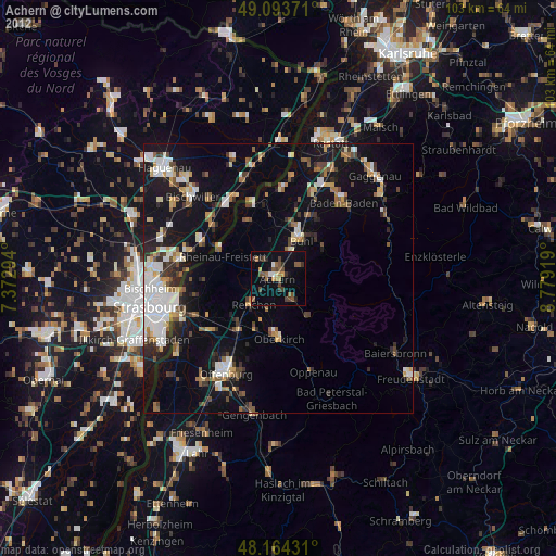
» Earth at Night: Flat Maps 2012, 2016