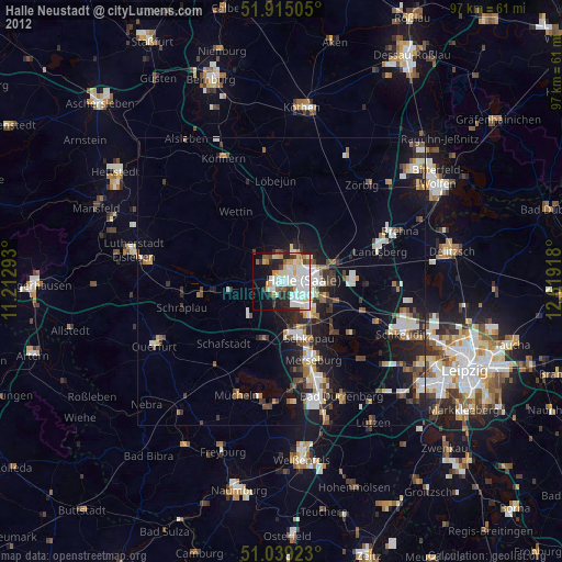
Halle Neustadt night lights from space
Night Light of Halle Neustadt (Saxony-Anhalt) from space (Germany) Src. Average luminocity for 10x10km area is 44.6484% and for 50x50km: 8.7568%.
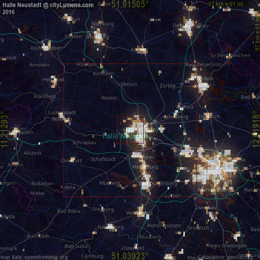
Analysis of Halle Neustadt night lights 2016
Square area 10x10 km:
 10.16%
90-99
16.98%80-89
3.21%70-79
4.01%60-69
3.74%50-59
0.67%40-49
3.61%30-39
6.28%20-29
12.17%10-19
13.9%0-9
25.27%Square area 50x50 km:
1.56%90-99
1.92%80-89
0.59%70-79
0.64%60-69
0.77%50-59
0.74%40-49
0.93%30-39
1.05%20-29
3.24%10-19
7.91%0-9
80.66%Clear (daylight) street map image can be seen on geolist.org.
Map coordinates:
51° 54' 54.2" North, 11° 12' 46.5" East
51° 28' 45.3" North, 11° 54' 57.8" East
51° 2' 21.2" North, 12° 37' 9" East
Some cities around Halle Neustadt sort by population:
• Merseburg
14.7 km =9.1 mi,  159°
159°
• Schkeuditz
23.1 km =14.4 mi,  113°
113°
• Bad Dürrenberg
22.9 km =14.2 mi,  153°
153°
• Teutschenthal
8.7 km =5.4 mi,  247°
247°
• Leuna
19.2 km =11.9 mi, 158°
• Braunsbedra
21.6 km =13.4 mi,  184°
184°
• Mücheln
21.6 km =13.4 mi,  200°
200°
• Bad Lauchstädt
10.8 km =6.7 mi, 197°
7289614 (p: 44,515)
Sources (retrieved 2019-11-25):
» Earth at Night: Flat Maps 2012, 2016