Grünstadt night lights from space
Night Light of Grünstadt (Rheinland-Pfalz) from space (Germany) Src. Average luminocity for 10x10km area is 10.8081% and for 50x50km: 14.2307%.
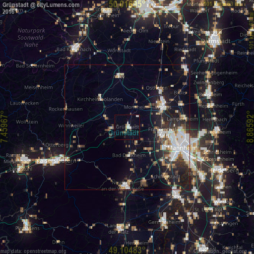
Analysis of Grünstadt night lights 2016
Square area 10x10 km:
 2.1%
2.1%90-99
2.38%80-89
0.56%70-79
0.28%60-69
0.84%50-59
0%40-49
1.68%30-39
0.56%20-29
1.68%10-19
2.38%0-9
87.54%Square area 50x50 km:
2.88%90-99
3.01%80-89
1.14%70-79
1.06%60-69
1.49%50-59
1.42%40-49
1.82%30-39
1.95%20-29
3.69%10-19
9.12%0-9
72.42%Clear (daylight) street map image can be seen on geolist.org.
Map coordinates:
50° 1' 1" North, 7° 27' 34.8" East
49° 33' 46.9" North, 8° 9' 46" East
49° 6' 17.4" North, 8° 51' 57.3" East
Some cities around Grünstadt sort by population:
• Frankenthal
14.1 km =8.8 mi,  103°
103°
• Bad Dürkheim
11.3 km =7 mi,  176°
176°
• Herxheim am Berg
6.1 km =3.8 mi,  168°
168°
• Bobenheim-Roxheim
14.3 km =8.9 mi,  79°
79°
• Eisenberg
6.6 km =4.1 mi,  265°
265°
• Heidesheim
3.2 km =2 mi,  47°
47°
• Maxdorf
12.5 km =7.8 mi,  131°
131°
• Lambsheim
10.6 km =6.6 mi,  121°
121°
2914101 (p: 13,424)
Sources (retrieved 2019-11-25):
» Earth at Night: Flat Maps 2012, 2016