Gera night lights from space
Night Light of Gera (Thuringia) from space (Germany) Src. Average luminocity for 10x10km area is 30.8866% and for 50x50km: 4.0882%.
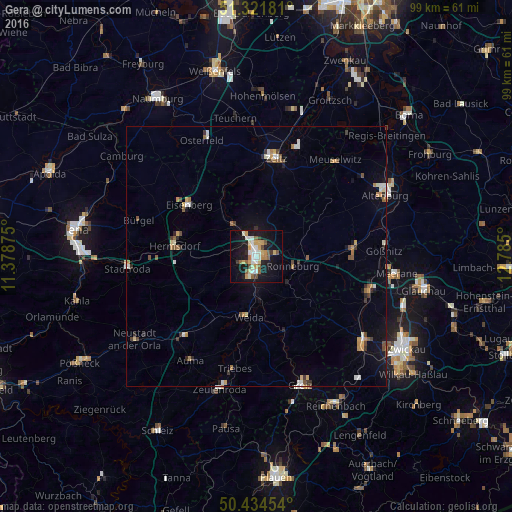
Analysis of Gera night lights 2016
Square area 10x10 km:
 4.34%
4.34%90-99
6.72%80-89
4.06%70-79
5.18%60-69
2.1%50-59
5.6%40-49
1.68%30-39
1.82%20-29
2.8%10-19
32.35%0-9
33.33%Square area 50x50 km:
0.48%90-99
0.62%80-89
0.36%70-79
0.55%60-69
0.52%50-59
0.61%40-49
0.42%30-39
0.53%20-29
0.43%10-19
2.46%0-9
93.02%Clear (daylight) street map image can be seen on geolist.org.
Map coordinates:
51° 19' 18.5" North, 11° 22' 43.5" East
50° 52' 49" North, 12° 4' 54.7" East
50° 26' 4.3" North, 12° 47' 6" East
Some cities around Gera sort by population:
• Zeitz
19.2 km =11.9 mi,  11°
11°
• Crimmitschau
22.8 km =14.2 mi,  108°
108°
• Schmölln
19.1 km =11.9 mi,  84°
84°
• Eisenberg
16 km =9.9 mi,  307°
307°
• Meuselwitz
23.7 km =14.7 mi,  40°
40°
• Weida
11.9 km =7.4 mi,  187°
187°
• Hermsdorf
16 km =9.9 mi,  276°
276°
• Ronneburg
7.6 km =4.7 mi,  104°
104°
2921232 (p: 104,659)
Sources (retrieved 2019-11-25):
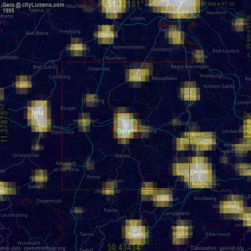
» NASA, Earths city lights 1995
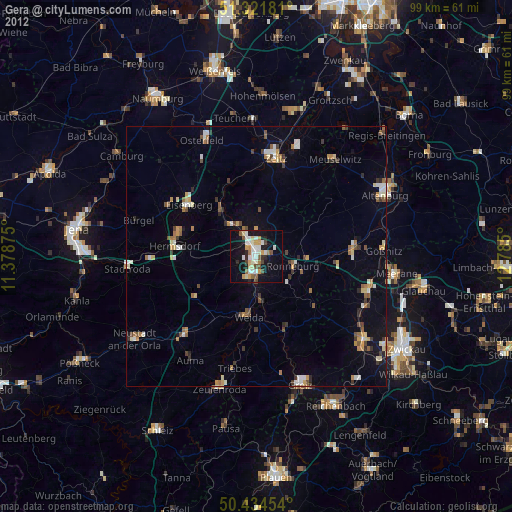
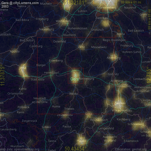
» NASA city lights 2003
» Earth at Night: Flat Maps 2012, 2016