Lemwerder night lights from space
Night Light of Lemwerder (Lower Saxony) from space (Germany) Src. Average luminocity for 10x10km area is 24.4078% and for 50x50km: 9.6735%.
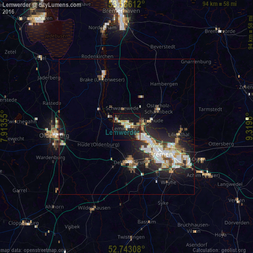
Analysis of Lemwerder night lights 2016
Square area 10x10 km:
 1.77%
1.77%90-99
4.55%80-89
3.28%70-79
2.9%60-69
5.18%50-59
0.51%40-49
3.28%30-39
0.63%20-29
5.81%10-19
35.23%0-9
36.87%Square area 50x50 km:
1.7%90-99
2.1%80-89
0.81%70-79
1%60-69
1.06%50-59
0.86%40-49
1.38%30-39
1.04%20-29
3.11%10-19
6.89%0-9
80.04%Clear (daylight) street map image can be seen on geolist.org.
Map coordinates:
53° 35' 10" North, 7° 54' 48.8" East
53° 10' 0" North, 8° 37' 0" East
52° 44' 35.1" North, 9° 19' 11.3" East
Some cities around Lemwerder sort by population:
• Delmenhorst
12.9 km =8 mi,  175°
175°
• Vegesack
0 km =0 mi,  0°
0°
• Burglesum
4.8 km =3 mi,  91°
91°
• Osterholz-Scharmbeck
13.7 km =8.5 mi,  60°
60°
• Schwanewede
7.5 km =4.7 mi,  351°
351°
• Hude
12.2 km =7.6 mi,  237°
237°
• Ritterhude
8.1 km =5 mi,  77°
77°
• Elsfleth
13.3 km =8.3 mi,  306°
306°
2878912 (p: 7,325)
Sources (retrieved 2019-11-25):
» Earth at Night: Flat Maps 2012, 2016