Brensbach night lights from space
Night Light of Brensbach (Hesse) from space (Germany) Src. Average luminocity for 10x10km area is 0.0321% and for 50x50km: 10.0786%.
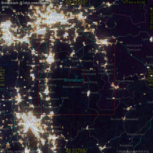
Analysis of Brensbach night lights 2016
Square area 10x10 km:
 0%
0%90-99
0%80-89
0%70-79
0%60-69
0%50-59
0%40-49
0%30-39
0%20-29
0%10-19
0%0-9
100%Square area 50x50 km:
1.3%90-99
1.55%80-89
0.82%70-79
1.01%60-69
1.23%50-59
1.14%40-49
1.41%30-39
1%20-29
2.82%10-19
11.93%0-9
75.79%Clear (daylight) street map image can be seen on geolist.org.
Map coordinates:
50° 13' 33.1" North, 8° 10' 52.8" East
49° 46' 26" North, 8° 53' 4" East
49° 19' 3.6" North, 9° 35' 15.3" East
Some cities around Brensbach sort by population:
• Groß-Umstadt
11.1 km =6.9 mi,  17°
17°
• Reinheim
7.1 km =4.4 mi,  330°
330°
• Ober-Ramstadt
11.6 km =7.2 mi,  303°
303°
• Groß-Zimmern
11.8 km =7.3 mi,  340°
340°
• Höchst im Odenwald
8.7 km =5.4 mi,  70°
70°
• Bad König
9.5 km =5.9 mi,  111°
111°
• Reichelsheim
7.6 km =4.7 mi,  205°
205°
• Lützelbach
9.1 km =5.7 mi,  247°
247°
2944254 (p: 5,438)
Sources (retrieved 2019-11-25):
» Earth at Night: Flat Maps 2012, 2016