Borna night lights from space
Night Light of Borna (Saxony) from space (Germany) Src. Average luminocity for 10x10km area is 5.8783% and for 50x50km: 6.5192%.
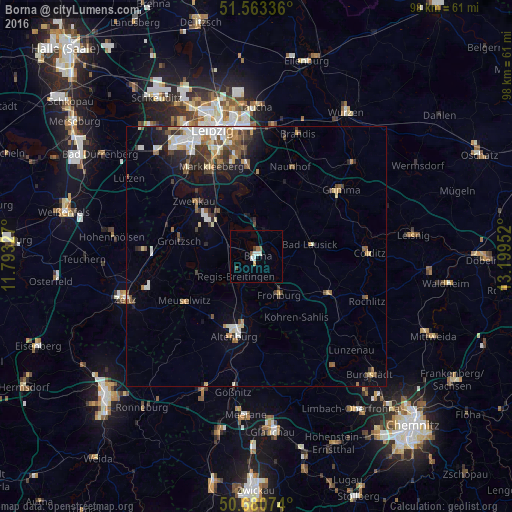
Analysis of Borna night lights 2016
Square area 10x10 km:
 1.2%
1.2%90-99
1.47%80-89
0.13%70-79
0.4%60-69
1.07%50-59
0.53%40-49
0.67%30-39
0.4%20-29
0%10-19
0.27%0-9
93.85%Square area 50x50 km:
1.07%90-99
1.28%80-89
0.65%70-79
0.54%60-69
0.78%50-59
0.95%40-49
0.83%30-39
1.14%20-29
1.15%10-19
2.89%0-9
88.73%Clear (daylight) street map image can be seen on geolist.org.
Map coordinates:
51° 33' 48.1" North, 11° 47' 35.8" East
51° 7' 27" North, 12° 29' 47" East
50° 40' 50.7" North, 13° 11' 58.3" East
Some cities around Borna sort by population:
• Altenburg
15.7 km =9.8 mi,  195°
195°
• Bad Lausick
10.6 km =6.6 mi,  77°
77°
• Zwenkau
15.7 km =9.8 mi,  312°
312°
• Frohburg
8.6 km =5.3 mi,  150°
150°
• Groitzsch
15.3 km =9.5 mi,  283°
283°
• Böhlen
11.5 km =7.1 mi,  317°
317°
• Kitzscher
6 km =3.7 mi,  41°
41°
• Großpösna
15.8 km =9.8 mi,  0°
0°
2946172 (p: 18,806)
Sources (retrieved 2019-11-25):
» Earth at Night: Flat Maps 2012, 2016