Blankenhain night lights from space
Night Light of Blankenhain (Thuringia) from space (Germany) Src. Average luminocity for 10x10km area is 0.1821% and for 50x50km: 6.6267%.
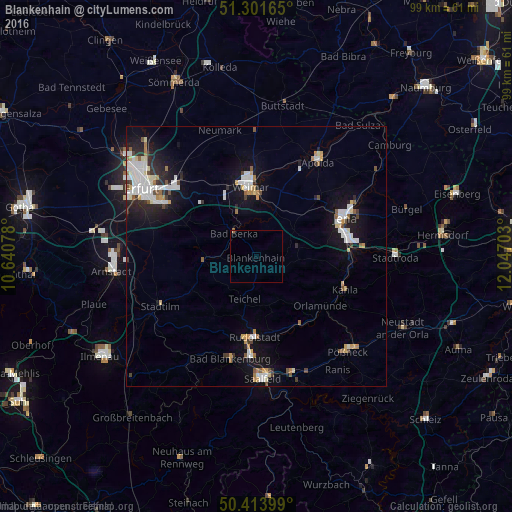
Analysis of Blankenhain night lights 2016
Square area 10x10 km:
 0%
0%90-99
0%80-89
0%70-79
0%60-69
0.28%50-59
0%40-49
0%30-39
0%20-29
0%10-19
0%0-9
99.72%Square area 50x50 km:
1.54%90-99
1.4%80-89
0.53%70-79
0.55%60-69
0.6%50-59
0.59%40-49
0.41%30-39
0.5%20-29
1.42%10-19
4.93%0-9
87.51%Clear (daylight) street map image can be seen on geolist.org.
Map coordinates:
51° 18' 5.9" North, 10° 38' 26.8" East
50° 51' 35.7" North, 11° 20' 38" East
50° 24' 50.4" North, 12° 2' 49.3" East
Some cities around Blankenhain sort by population:
• Jena
18.9 km =11.7 mi,  66°
66°
• Weimar
13.4 km =8.3 mi,  355°
355°
• Rudolstadt
15.5 km =9.6 mi,  180°
180°
• Apolda
22.1 km =13.7 mi,  33°
33°
• Bad Berka
6.2 km =3.9 mi,  315°
315°
• Bad Blankenburg
20.4 km =12.7 mi,  194°
194°
• Kahla
18 km =11.2 mi,  109°
109°
• Stadtilm
20.6 km =12.8 mi,  243°
243°
2948058 (p: 6,920)
Sources (retrieved 2019-11-25):
» Earth at Night: Flat Maps 2012, 2016