Bitburg night lights from space
Night Light of Bitburg (Rheinland-Pfalz) from space (Germany) Src. Average luminocity for 10x10km area is 7.2157% and for 50x50km: 2.6659%.
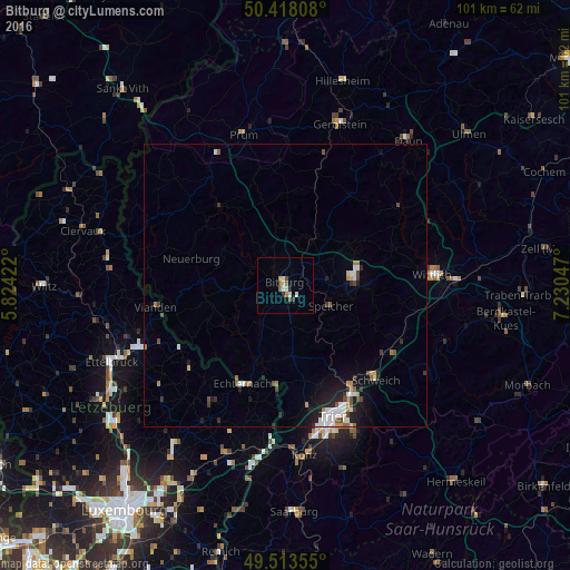
Analysis of Bitburg night lights 2016
Square area 10x10 km:
 0.7%
0.7%90-99
1.54%80-89
0.84%70-79
0.98%60-69
0.42%50-59
1.68%40-49
1.12%30-39
0.98%20-29
0.7%10-19
0.56%0-9
90.48%Square area 50x50 km:
0.39%90-99
0.54%80-89
0.09%70-79
0.23%60-69
0.37%50-59
0.34%40-49
0.37%30-39
0.39%20-29
0.58%10-19
1.56%0-9
95.13%Clear (daylight) street map image can be seen on geolist.org.
Map coordinates:
50° 25' 5.1" North, 5° 49' 27.2" East
49° 58' 4.6" North, 6° 31' 38.4" East
49° 30' 48.8" North, 7° 13' 49.7" East
Some cities around Bitburg sort by population:
• Trier
24.9 km =15.5 mi,  161°
161°
• Wittlich
26.2 km =16.3 mi,  85°
85°
• Konz
30 km =18.6 mi,  173°
173°
• Gerolstein
29.8 km =18.5 mi,  18°
18°
• Schweich
22.9 km =14.2 mi,  135°
135°
• Diekirch, LU
28.8 km =17.9 mi,  247°
247°
• Prüm
27.7 km =17.2 mi,  344°
344°
• Grevenmacher, LU
32.9 km =20.4 mi,  190°
190°
2948184 (p: 12,908)
Sources (retrieved 2019-11-25):
» Earth at Night: Flat Maps 2012, 2016