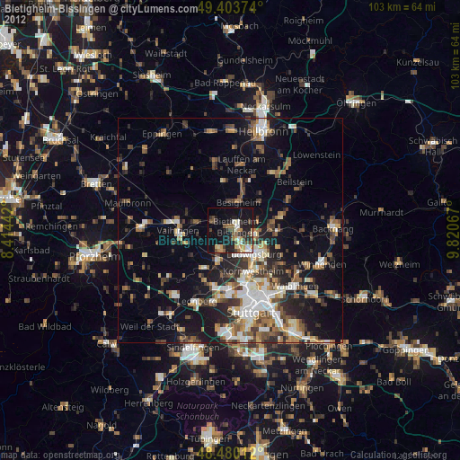
Bietigheim-Bissingen night lights from space
Night Light of Bietigheim-Bissingen (Baden-Württemberg) from space (Germany) Src. Average luminocity for 10x10km area is 41.0625% and for 50x50km: 24.6781%.
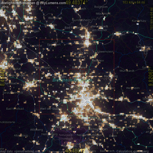
Analysis of Bietigheim-Bissingen night lights 2016
Square area 10x10 km:
 6.39%
6.39%90-99
7.95%80-89
2.27%70-79
6.68%60-69
7.39%50-59
4.12%40-49
4.69%30-39
6.68%20-29
15.48%10-19
31.53%0-9
6.82%Square area 50x50 km:
4.06%90-99
4.66%80-89
2.02%70-79
2.66%60-69
3.34%50-59
3.14%40-49
3.52%30-39
3.88%20-29
6.78%10-19
15.58%0-9
50.34%Clear (daylight) street map image can be seen on geolist.org.
Map coordinates:
49° 24' 13.5" North, 8° 24' 51.9" East
48° 56' 38.7" North, 9° 7' 3.2" East
48° 28' 48.4" North, 9° 49' 14.4" East
Some cities around Bietigheim-Bissingen sort by population:
• Sachsenheim
4.2 km =2.6 mi,  294°
294°
• Freiberg am Neckar
6.3 km =3.9 mi,  102°
102°
• Markgröningen
5.1 km =3.2 mi,  211°
211°
• Asperg
4.5 km =2.8 mi,  163°
163°
• Tamm
2.7 km =1.7 mi,  183°
183°
• Besigheim
6.3 km =3.9 mi,  17°
17°
• Möglingen
6.3 km =3.9 mi,  173°
173°
• Pleidelsheim
6.5 km =4 mi,  74°
74°
2949012 (p: 41,769)
Sources (retrieved 2019-11-25):
» Earth at Night: Flat Maps 2012, 2016