Haßfurt night lights from space
Night Light of Haßfurt (Bavaria) from space (Germany) Src. Average luminocity for 10x10km area is 3.2619% and for 50x50km: 2.6933%.
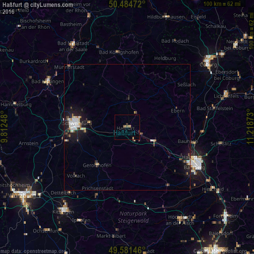
Analysis of Haßfurt night lights 2016
Square area 10x10 km:
 0%
0%90-99
0%80-89
0%70-79
1.26%60-69
0.98%50-59
0.56%40-49
0.98%30-39
0.7%20-29
0%10-19
0%0-9
95.52%Square area 50x50 km:
0.42%90-99
0.5%80-89
0.22%70-79
0.22%60-69
0.24%50-59
0.31%40-49
0.35%30-39
0.39%20-29
0.73%10-19
2.66%0-9
93.97%Clear (daylight) street map image can be seen on geolist.org.
Map coordinates:
50° 29' 5" North, 9° 48' 44.9" East
50° 2' 6.8" North, 10° 30' 56.2" East
49° 34' 53.3" North, 11° 13' 7.4" East
Some cities around Haßfurt sort by population:
• Schweinfurt
21 km =13 mi,  274°
274°
• Schonungen
14.9 km =9.3 mi,  276°
276°
• Gerolzhofen
19.2 km =11.9 mi,  218°
218°
• Knetzgau
6.3 km =3.9 mi,  156°
156°
• Gochsheim
16.7 km =10.4 mi,  262°
262°
• Zeil
6.3 km =3.9 mi,  116°
116°
• Eltmann
12.9 km =8 mi, 123°
• Hofheim in Unterfranken
11.3 km =7 mi,  2°
2°
2909335 (p: 13,562)
Sources (retrieved 2019-11-25):
» Earth at Night: Flat Maps 2012, 2016