Ainring night lights from space
Night Light of Ainring (Bavaria) from space (Germany) Src. Average luminocity for 10x10km area is 26.7113% and for 50x50km: 5.3022%.
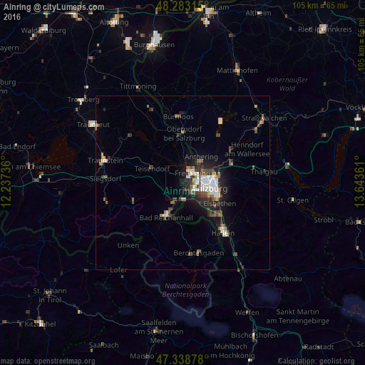
Analysis of Ainring night lights 2016
Square area 10x10 km:
 6.1%
6.1%90-99
5.8%80-89
2.53%70-79
1.34%60-69
2.98%50-59
2.83%40-49
2.53%30-39
4.61%20-29
10.12%10-19
13.84%0-9
47.32%Square area 50x50 km:
0.93%90-99
0.93%80-89
0.34%70-79
0.35%60-69
0.67%50-59
0.8%40-49
0.89%30-39
0.61%20-29
1.7%10-19
3.2%0-9
89.56%Clear (daylight) street map image can be seen on geolist.org.
Map coordinates:
48° 16' 59.3" North, 12° 14' 14.5" East
47° 48' 47.2" North, 12° 56' 25.7" East
47° 20' 19.6" North, 13° 38' 37" East
Some cities around Ainring sort by population:
• Salzburg, AT
7.9 km =4.9 mi,  101°
101°
• Bad Reichenhall
10.4 km =6.5 mi,  206°
206°
• Freilassing
4.3 km =2.7 mi,  44°
44°
• Teisendorf
9.9 km =6.2 mi,  293°
293°
• Hallein, AT
18.7 km =11.6 mi,  140°
140°
• Laufen
13.7 km =8.5 mi,  356°
356°
• Oberndorf bei Salzburg, AT
15.2 km =9.4 mi, 357°
• Piding
5.5 km =3.4 mi,  199°
199°
2958831 (p: 10,028)
Sources (retrieved 2019-11-25):
» Earth at Night: Flat Maps 2012, 2016