Hallein night lights from space
Night Light of Hallein (Salzburg) from space (Austria) Src. Average luminocity for 10x10km area is 11.2753% and for 50x50km: 4.6804%.
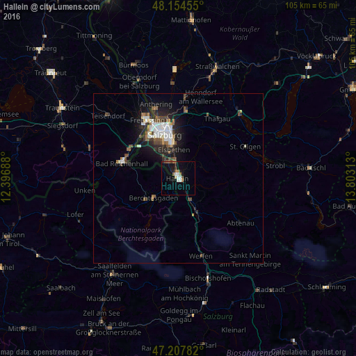
Analysis of Hallein night lights 2016
Square area 10x10 km:
 1.64%
1.64%90-99
1.93%80-89
0.45%70-79
0.15%60-69
2.68%50-59
1.34%40-49
1.34%30-39
0.6%20-29
1.93%10-19
6.85%0-9
81.1%Square area 50x50 km:
0.92%90-99
0.86%80-89
0.28%70-79
0.26%60-69
0.54%50-59
0.63%40-49
0.75%30-39
0.57%20-29
1.52%10-19
3.17%0-9
90.48%Clear (daylight) street map image can be seen on geolist.org.
Map coordinates:
48° 9' 16.4" North, 12° 23' 48.8" East
47° 40' 60" North, 13° 6' 0" East
47° 12' 28.2" North, 13° 48' 11.3" East
Some cities around Hallein sort by population:
• Salzburg
13.6 km =8.5 mi,  342°
342°
• Bad Reichenhall, DE
17.4 km =10.8 mi,  287°
287°
• Freilassing, DE
19.6 km =12.2 mi,  333°
333°
• Ainring, DE
18.7 km =11.6 mi,  320°
320°
• Berchtesgaden, DE
9.3 km =5.8 mi,  232°
232°
• Bischofswiesen, DE
10.5 km =6.5 mi,  236°
236°
• Schönau am Königssee, DE
12.5 km =7.8 mi,  222°
222°
• Piding, DE
16.5 km =10.3 mi,  304°
304°
2776951 (p: 7,208)
Sources (retrieved 2019-11-25):
» Earth at Night: Flat Maps 2012, 2016