Tišnov night lights from space
Night Light of Tišnov (South Moravian) from space (Czech Republic) Src. Average luminocity for 10x10km area is 4.7687% and for 50x50km: 8.2756%.
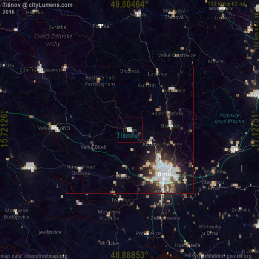
Analysis of Tišnov night lights 2016
Square area 10x10 km:
 0.67%
0.67%90-99
1.34%80-89
0.13%70-79
1.07%60-69
0%50-59
0%40-49
0%30-39
1.34%20-29
1.87%10-19
0%0-9
93.58%Square area 50x50 km:
1.8%90-99
1.88%80-89
0.5%70-79
0.65%60-69
0.84%50-59
1.09%40-49
0.96%30-39
1.09%20-29
2.52%10-19
3.51%0-9
85.16%Clear (daylight) street map image can be seen on geolist.org.
Map coordinates:
49° 48' 16.7" North, 15° 43' 16.5" East
49° 20' 55.4" North, 16° 25' 27.8" East
48° 53' 18.7" North, 17° 7' 39" East
Some cities around Tišnov sort by population:
• Brno
21.6 km =13.4 mi,  142°
142°
• Blansko
16 km =9.9 mi,  84°
84°
• Boskovice
23 km =14.3 mi,  47°
47°
• Kuřim
9.6 km =6 mi,  125°
125°
• Bystřice nad Pernštejnem
22.7 km =14.1 mi,  328°
328°
• Letovice
24.6 km =15.3 mi,  26°
26°
• Rosice
18.7 km =11.6 mi,  188°
188°
• Náměšť nad Oslavou
24.9 km =15.5 mi,  230°
230°
3064211 (p: 8,227)
Sources (retrieved 2019-11-25):
» Earth at Night: Flat Maps 2012, 2016