Rosice night lights from space
Night Light of Rosice (South Moravian) from space (Czech Republic) Src. Average luminocity for 10x10km area is 8.4146% and for 50x50km: 8.9053%.
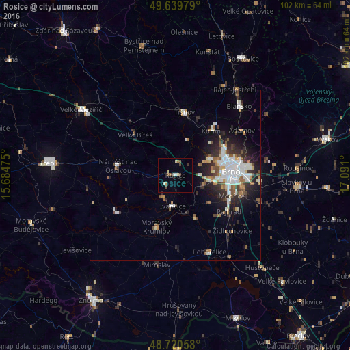
Analysis of Rosice night lights 2016
Square area 10x10 km:
 0.28%
0.28%90-99
1.54%80-89
1.54%70-79
0.56%60-69
0.7%50-59
1.26%40-49
1.82%30-39
1.26%20-29
0.56%10-19
0.56%0-9
89.92%Square area 50x50 km:
1.86%90-99
1.98%80-89
0.59%70-79
0.66%60-69
0.88%50-59
1.1%40-49
1.04%30-39
1.22%20-29
2.74%10-19
4.34%0-9
83.6%Clear (daylight) street map image can be seen on geolist.org.
Map coordinates:
49° 38' 23.2" North, 15° 41' 5.1" East
49° 10' 56.4" North, 16° 23' 16.3" East
48° 43' 14.1" North, 17° 5' 27.6" East
Some cities around Rosice sort by population:
• Brno
16.1 km =10 mi,  84°
84°
• Blansko
27.4 km =17 mi,  42°
42°
• Ivančice
9 km =5.6 mi,  184°
184°
• Kuřim
16.6 km =10.3 mi, 38°
• Tišnov
18.7 km =11.6 mi,  8°
8°
• Šlapanice
24.7 km =15.3 mi,  93°
93°
• Moravský Krumlov
15.8 km =9.8 mi,  200°
200°
• Náměšť nad Oslavou
16.9 km =10.5 mi,  279°
279°
3066759 (p: 5,287)
Sources (retrieved 2019-11-25):
» Earth at Night: Flat Maps 2012, 2016