Brno night lights from space
Night Light of Brno (South Moravian) from space (Czech Republic) Src. Average luminocity for 10x10km area is 82.1737% and for 50x50km: 9.6088%.
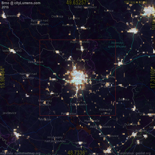
Analysis of Brno night lights 2016
Square area 10x10 km:
 33.61%
90-99
28.99%80-89
4.06%70-79
5.18%60-69
4.62%50-59
8.68%40-49
5.6%30-39
4.9%20-29
4.34%10-19
0%0-9
0%Square area 50x50 km:
1.84%90-99
1.97%80-89
0.64%70-79
0.78%60-69
0.96%50-59
1.24%40-49
1.23%30-39
1.46%20-29
3.04%10-19
4.58%0-9
82.25%Clear (daylight) street map image can be seen on geolist.org.
Map coordinates:
49° 39' 9.3" North, 15° 54' 17.4" East
49° 11' 42.8" North, 16° 36' 28.7" East
48° 44' 1" North, 17° 18' 39.9" East
Some cities around Brno sort by population:
• Blansko
18.8 km =11.7 mi,  8°
8°
• Ivančice
19.7 km =12.2 mi,  238°
238°
• Kuřim
12.8 km =8 mi,  334°
334°
• Tišnov
21.6 km =13.4 mi,  322°
322°
• Šlapanice
9.2 km =5.7 mi,  108°
108°
• Slavkov u Brna
20.1 km =12.5 mi,  103°
103°
• Rosice
16.1 km =10 mi,  264°
264°
• Rousínov
19.9 km =12.4 mi,  88°
88°
3078610 (p: 369,559)
Sources (retrieved 2019-11-25):
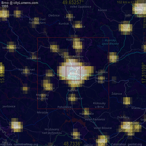
» NASA, Earths city lights 1995
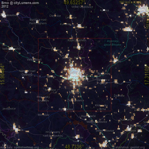
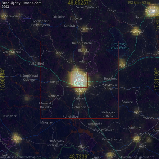
» NASA city lights 2003
» Earth at Night: Flat Maps 2012, 2016