Letovice night lights from space
Night Light of Letovice (South Moravian) from space (Czech Republic) Src. Average luminocity for 10x10km area is 2.542% and for 50x50km: 1.7628%.
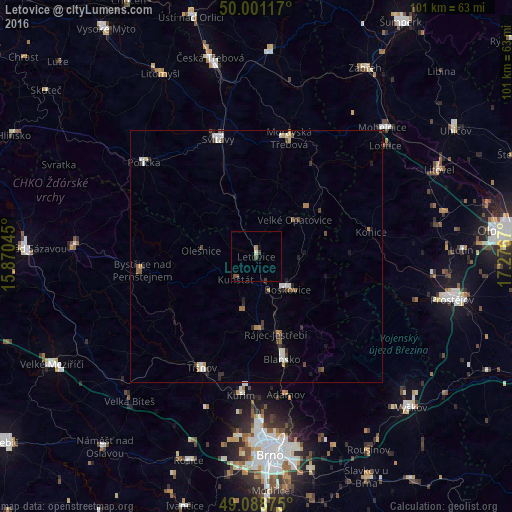
Analysis of Letovice night lights 2016
Square area 10x10 km:
 0%
0%90-99
0.28%80-89
0.28%70-79
0%60-69
0.56%50-59
0.7%40-49
1.54%30-39
0.28%20-29
0%10-19
0.14%0-9
96.22%Square area 50x50 km:
0.21%90-99
0.38%80-89
0.08%70-79
0.18%60-69
0.2%50-59
0.25%40-49
0.31%30-39
0.26%20-29
0.37%10-19
0.39%0-9
97.37%Clear (daylight) street map image can be seen on geolist.org.
Map coordinates:
50° 0' 4.2" North, 15° 52' 13.6" East
49° 32' 49.5" North, 16° 34' 24.9" East
49° 5' 19.5" North, 17° 16' 36.1" East
Some cities around Letovice sort by population:
• Blansko
21.1 km =13.1 mi,  165°
165°
• Svitavy
24.4 km =15.2 mi,  341°
341°
• Moravská Třebová
24.3 km =15.1 mi,  15°
15°
• Boskovice
9.1 km =5.7 mi,  136°
136°
• Kuřim
27.8 km =17.3 mi,  186°
186°
• Polička
29 km =18 mi,  310°
310°
• Bystřice nad Pernštejnem
22.7 km =14.1 mi,  263°
263°
• Tišnov
24.6 km =15.3 mi,  206°
206°
3072130 (p: 6,799)
Sources (retrieved 2019-11-25):
» Earth at Night: Flat Maps 2012, 2016