Strakonice night lights from space
Night Light of Strakonice (Jihočeský kraj) from space (Czech Republic) Src. Average luminocity for 10x10km area is 11.2928% and for 50x50km: 1.4311%.
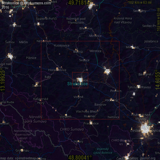
Analysis of Strakonice night lights 2016
Square area 10x10 km:
 3.07%
3.07%90-99
1.74%80-89
0.4%70-79
0.13%60-69
1.47%50-59
1.34%40-49
1.47%30-39
1.6%20-29
0.8%10-19
2.14%0-9
85.83%Square area 50x50 km:
0.26%90-99
0.25%80-89
0.08%70-79
0.06%60-69
0.2%50-59
0.1%40-49
0.36%30-39
0.17%20-29
0.19%10-19
0.41%0-9
97.91%Clear (daylight) street map image can be seen on geolist.org.
Map coordinates:
49° 43' 5.3" North, 13° 11' 57.3" East
49° 15' 41.1" North, 13° 54' 8.5" East
48° 48' 1.5" North, 14° 36' 19.8" East
Some cities around Strakonice sort by population:
• Písek
18.5 km =11.5 mi,  73°
73°
• Prachatice
28.5 km =17.7 mi,  165°
165°
• Sušice
27.9 km =17.3 mi,  263°
263°
• Vimperk
24.2 km =15 mi,  201°
201°
• Blatná
18.2 km =11.3 mi,  355°
355°
• Vodňany
23.5 km =14.6 mi,  122°
122°
• Horažďovice
16 km =9.9 mi,  294°
294°
• Protivín
23.9 km =14.9 mi,  106°
106°
3065067 (p: 23,545)
Sources (retrieved 2019-11-25):
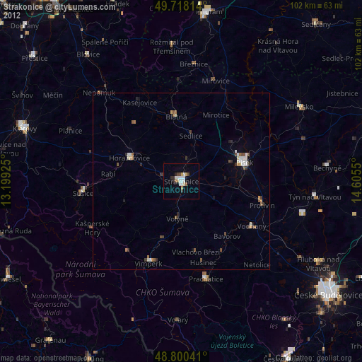
» Earth at Night: Flat Maps 2012, 2016