Prachatice night lights from space
Night Light of Prachatice (Jihočeský kraj) from space (Czech Republic) Src. Average luminocity for 10x10km area is 3.7708% and for 50x50km: 0.8541%.
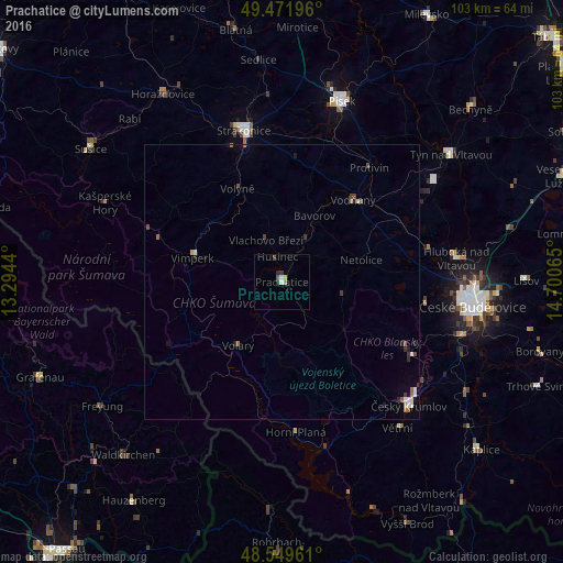
Analysis of Prachatice night lights 2016
Square area 10x10 km:
 0.89%
0.89%90-99
0.3%80-89
0.45%70-79
0.74%60-69
0%50-59
0.15%40-49
1.04%30-39
1.34%20-29
0.45%10-19
0.6%0-9
94.05%Square area 50x50 km:
0.12%90-99
0.11%80-89
0.06%70-79
0.07%60-69
0.13%50-59
0.1%40-49
0.21%30-39
0.19%20-29
0.19%10-19
0.19%0-9
98.63%Clear (daylight) street map image can be seen on geolist.org.
Map coordinates:
49° 28' 19.1" North, 13° 17' 39.8" East
49° 0' 46.5" North, 13° 59' 51.1" East
48° 32' 58.6" North, 14° 42' 2.3" East
Some cities around Prachatice sort by population:
• České Budějovice
35 km =21.7 mi,  97°
97°
• Písek
34.7 km =21.6 mi,  18°
18°
• Strakonice
28.5 km =17.7 mi,  345°
345°
• Český Krumlov
32.3 km =20.1 mi,  134°
134°
• Týn nad Vltavou
38.7 km =24 mi,  52°
52°
• Vimperk
16.5 km =10.3 mi,  287°
287°
• Vodňany
19.8 km =12.3 mi,  40°
40°
• Protivín
26.2 km =16.3 mi, 37°
3067713 (p: 11,803)
Sources (retrieved 2019-11-25):
» Earth at Night: Flat Maps 2012, 2016