Blatná night lights from space
Night Light of Blatná (Jihočeský kraj) from space (Czech Republic) Src. Average luminocity for 10x10km area is 1.1872% and for 50x50km: 1.3888%.
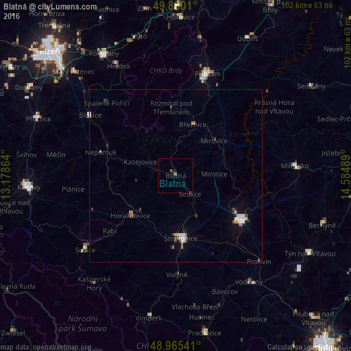
Analysis of Blatná night lights 2016
Square area 10x10 km:
 0%
0%90-99
0%80-89
0%70-79
0%60-69
0.94%50-59
0.13%40-49
0%30-39
0.27%20-29
0.67%10-19
0.94%0-9
97.06%Square area 50x50 km:
0.27%90-99
0.24%80-89
0.06%70-79
0.07%60-69
0.2%50-59
0.12%40-49
0.23%30-39
0.19%20-29
0.18%10-19
0.43%0-9
98.01%Clear (daylight) street map image can be seen on geolist.org.
Map coordinates:
49° 52' 48.4" North, 13° 10' 43.1" East
49° 25' 29.6" North, 13° 52' 54.3" East
48° 57' 55.5" North, 14° 35' 5.6" East
Some cities around Blatná sort by population:
• Příbram
30.9 km =19.2 mi,  17°
17°
• Písek
23.2 km =14.4 mi,  123°
123°
• Strakonice
18.2 km =11.3 mi,  175°
175°
• Sušice
33.9 km =21.1 mi,  230°
230°
• Milevsko
34.7 km =21.6 mi,  85°
85°
• Vodňany
37.4 km =23.2 mi,  145°
145°
• Horažďovice
17.5 km =10.9 mi, 228°
• Protivín
34.9 km =21.7 mi,  135°
135°
3079252 (p: 6,735)
Sources (retrieved 2019-11-25):
» Earth at Night: Flat Maps 2012, 2016